You are in an author page
How to Get to NRG Stadium (Houston) for the World Cup: A Driving Guide
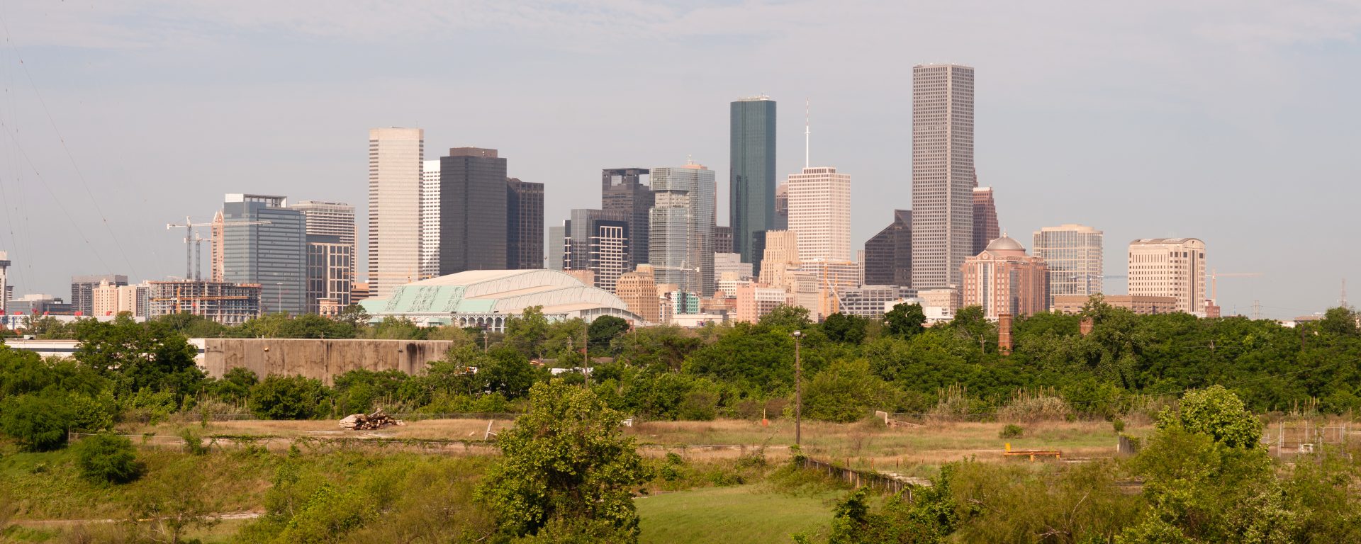
With seven World Cup 2026 matches scheduled at NRG Stadium, including group stage clashes featuring Portugal, Germany, and the Netherlands, plus a Round of 16 on the Fourth of July, Houston is one of the most action-packed host cities in the entire tournament. The stadium sits in NRG Park on Houston’s south side, ringed by Loop 610 and accessible from every corner of the metro.
Unlike AT&T Stadium in Arlington, NRG Stadium does have a public transit option. The METRORail Red Line runs directly to NRG Park station, making it a genuinely viable alternative for fans staying near the rail corridor. But for the majority of fans arriving from across Greater Houston, from both airports, or road-tripping from Dallas, driving remains the primary mode, and the roads around NRG Park include some of Houston’s most heavily used toll infrastructure.
This guide covers the best driving routes from every major approach corridor, the toll roads you will encounter, what to expect from match day traffic, and everything you need to know to arrive smoothly at Houston Stadium.
Quick Facts: NRG Stadium (Houston Stadium)
- Address: 1 NRG Pkwy, Houston, TX 77054 (main event address: 8825 Kirby Drive for GPS)
- Official FIFA tournament name: Houston Stadium
- World Cup capacity: 68,311
- World Cup matches: 7 (5 group stage, 1 Round of 32, 1 Round of 16)
- Primary access roads: Loop 610 (South), US-288, Kirby Drive, Main Street
- METRORail: Red Line to NRG Park station (direct from downtown, every 6 minutes during World Cup)
- Nearest airports: Hobby Airport (HOU, 8 mi), George Bush Intercontinental (IAH, 22 mi)
- Retractable roof: Yes. All matches played in climate-controlled conditions
World Cup 2026 Match Schedule at NRG Stadium
NRG Stadium hosts seven matches across the group stage, Round of 32, and Round of 16. During the tournament, the venue is officially named Houston Stadium in all FIFA broadcasts, signage, and communications. The July 4 Round of 16 match is the most atmospherically distinctive fixture in the entire tournament, coinciding with Independence Day celebrations across the city.
| Date | Match | Kickoff (CT) | Round | Stadium Name |
| Sun Jun 14 | Germany vs. Curacao | 12:00 PM | Group Stage | Houston Stadium |
| Wed Jun 17 | Portugal vs. FIFA Playoff 1 | 12:00 PM | Group Stage | Houston Stadium |
| Sat Jun 20 | Netherlands vs. UEFA Playoff B | 12:00 PM | Group Stage | Houston Stadium |
| Tue Jun 23 | Portugal vs. Uzbekistan | 12:00 PM | Group Stage | Houston Stadium |
| Fri Jun 27 | TBD vs. TBD (Group F/K finale) | TBD | Group Stage | Houston Stadium |
| Mon Jun 29 | TBD vs. TBD | 12:00 PM | Round of 32 | Houston Stadium |
| Fri Jul 4 | TBD vs. TBD | 12:00 PM | Round of 16 | Houston Stadium |
Note: The July 4 Round of 16 is one of the most unique fixtures in the tournament calendar. The match ends around 2:00 PM CT, leaving the entire evening for Houston’s Fourth of July events. Post-match traffic will disperse more quickly than a typical evening fixture, but match day road closures and managed traffic flows will still be in effect around NRG Park until mid-afternoon.
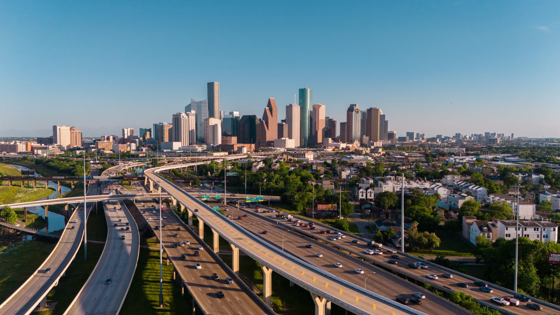
The Toll Roads Around NRG Stadium
NRG Stadium is located inside Loop 610, which is a non-tolled freeway. However, many of the approach routes from across Greater Houston pass through or connect to Houston’s extensive toll network, operated by the Harris County Toll Road Authority (HCTRA) and TxDOT.
For fans arriving from north of the city, both airports, or road-tripping from Dallas, toll roads are part of the journey. Understanding which ones you will encounter and having your payment method set up before you drive is the single most important preparation step.
Toll roads on major approach routes to NRG Stadium
- Sam Houston Tollway (Beltway 8): The 88-mile inner beltway around Houston, operated by HCTRA. Fully electronic, no cash lanes. Fans driving from Katy, Sugar Land, Pasadena, or the northern suburbs will often use Beltway 8 to connect to Loop 610 southbound toward NRG Park.
- Hardy Toll Road: The primary north-south toll spine connecting George Bush Intercontinental Airport (IAH) directly to Loop 610 near NRG Park. Fully electronic, no cash. End-to-end cost approximately $4 to $5 with EZ TAG or NextPass. The Hardy Connector links directly into IAH terminals.
- Westpark Tollway: East-west route serving fans coming from Katy and the western suburbs before connecting south toward the stadium. Fully electronic, jointly operated by HCTRA and Fort Bend County.
- Grand Parkway (SH 99): The outer beltway used by fans from The Woodlands, Katy, Sugar Land, and other outer suburbs connecting to I-45 or I-10 before heading toward NRG Park. TxDOT-operated segments, fully electronic.
- Fort Bend Parkway Toll Road: Relevant for fans driving from Missouri City or Fort Bend County directly northward toward NRG Park via SH-90A.
How to pay Texas toll roads without a transponder: All HCTRA and TxDOT toll roads in the Houston area are fully electronic. Driving through without a registered payment method means the toll is photographed and billed to the vehicle’s registered owner (or passed on by your rental car company with an admin fee). The NextPass app covers all Texas toll roads, including Beltway 8, the Hardy Toll Road, and the Grand Parkway. Register your license plate before your first match day and pay as you go. Please note: NextPass does not cover tolls for rental cars in Texas, though. See our Ultimate Guide to Texas Toll Roads for more information.
How to Get to NRG Stadium: Routes from Major Areas
The stadium is straightforward to reach once you are on Loop 610. The two main entry streets are Kirby Drive (east side of NRG Park, Gate 9) and Main Street (west side). Your parking assignment will determine which entry you should use. Always follow the route instructions attached to your parking pass rather than relying solely on GPS.
| Arriving From | Primary Route | Key Exit / Turn | Estimated Drive |
| Downtown Houston | US-288 South to Loop 610 West | Kirby Dr or Fannin St | 15-20 min |
| George Bush Airport (IAH) | Hardy Toll Road South to I-610 West | Kirby Dr or Main St | 30-40 min |
| Hobby Airport (HOU) | I-45 North to Loop 610 West | Kirby Dr or Fannin St | 15-25 min |
| The Woodlands / North Houston | I-45 South to Loop 610 West | Kirby Dr or Main St | 45-55 min |
| Katy / West Houston | I-10 East to Loop 610 South | Main St or Kirby Dr | 30-45 min |
| Sugar Land / Southwest | US-59 North (I-69) to Loop 610 South | Main St or Kirby Dr | 30-40 min |
| Pearland / South Houston | SH-288 North to Loop 610 West | Kirby Dr or Fannin St | 20-30 min |
| Galveston / Southeast | I-45 North to Loop 610 West | Kirby Dr or Fannin St | 60-75 min |
| Dallas | I-45 South all the way into Houston to Loop 610 West | Kirby Dr | 3.5-4 hrs |
GPS note: For NRG Stadium events, use the address 8825 Kirby Drive, Houston, TX 77054 for the main gate entrance. Standard GPS destinations for ‘NRG Stadium’ or ‘1 NRG Pkwy’ may route you to different entry points that are not appropriate for all parking zones on World Cup match days.
Route Details: Getting to NRG Stadium
From Downtown Houston (15 to 20 minutes in normal traffic)
The quickest route from downtown is US-288 South toward Loop 610, then exit onto Kirby Drive or Fannin Street, following signs into NRG Park. US-288 has a tolled express lane option (SH-288 Toll) running parallel to the main lanes for part of its length. The main lanes are free, but the toll lanes offer a faster option during congestion.
Downtown is close, but match day traffic on US-288 and Loop 610 southbound will be significant. A journey that normally takes 15 minutes can take 45 to 60 minutes in the hour before kickoff. Leave at least 90 minutes before kickoff from downtown, more for Portugal and Netherlands matches.
From George Bush Intercontinental Airport (IAH) (30 to 40 minutes in normal traffic)
IAH is the primary international arrival point for World Cup fans flying into Houston, and the Hardy Toll Road is the most direct route. Take the Hardy Connector from IAH terminals directly onto the Hardy Toll Road southbound, follow it to Loop 610 West, then exit onto Kirby Drive or Main Street toward NRG Park. The Hardy Toll Road is fully electronic and costs approximately $4 to $5 for the full run to 610.
International visitors picking up rental cars at IAH should set up a toll payment method before leaving the rental facility. The Hardy Toll Road has no cash option and no way to pay on the spot. NextPass covers the full journey from IAH to NRG Park on a single app.
From Hobby Airport (HOU) (15 to 25 minutes in normal traffic)
Hobby Airport is just 8 miles from NRG Stadium, making it the closer of the two airports. From HOU, take I-45 North briefly and then connect to Loop 610 West, exiting at Kirby Drive or Fannin Street. This route does not involve toll roads, making it the most straightforward approach for fans arriving at Hobby. On match days, allow extra time as I-45 near the 610 interchange will carry additional traffic.
From The Woodlands and North Houston (45 to 55 minutes in normal traffic)
Fans from The Woodlands, Spring, or the northern suburbs will typically take I-45 South directly into Houston and connect to Loop 610 West toward NRG Park. The Hardy Toll Road is a faster alternative to I-45 for this approach, running parallel to the freeway with less congestion on match days. From Beltway 8 (Sam Houston Tollway) intersections further north, fans can also cut across to I-45 or US-59 to approach from different directions.
From Katy and West Houston (30 to 45 minutes in normal traffic)
From Katy and the western suburbs, the main route is I-10 East to Loop 610 South, exiting at Main Street or Kirby Drive. The Westpark Tollway is an alternative for fans coming from the far west, connecting to US-59 North before joining 610. The Sam Houston Tollway (Beltway 8) is also an option for circling south and approaching the stadium from that direction. All three corridors are tolled in sections.
From Sugar Land and the Southwest (30 to 40 minutes in normal traffic)
From Sugar Land, US-59 North (I-69) is the direct route into Houston, connecting to Loop 610 South toward NRG Park. The Fort Bend Parkway Toll Road is an alternative approach for fans further south in Fort Bend County, heading north toward the SH-90A / Main Street corridor. US-59 is not tolled, but connecting segments and the Fort Bend Parkway are.
From Dallas (3.5 to 4 hours)
The Dallas-to-Houston drive is one of the most popular road trip corridors in Texas for World Cup fans attending matches in both cities. The standard route is I-45 South all the way from Dallas into Houston, connecting to Loop 610 West and exiting at Kirby Drive. I-45 is not tolled, but the final approach through Houston’s toll network may involve sections of Beltway 8 or other toll roads depending on where you are staying.
NextPass covers all Texas toll roads on both ends of this journey. Fans driving the full Dallas-to-Houston corridor for multiple matches should set up NextPass once and it handles every toll road on both legs.
Match Day Traffic: What to Expect at NRG Stadium
NRG Stadium and NRG Park have hosted Super Bowls, major concerts, and international soccer tournaments before. The World Cup will bring higher demand than any previous event at this venue. A few important things to plan around:
- Arrive at least two hours before kickoff. For high-demand matches featuring Portugal (June 17 and June 23) and the Netherlands (June 20), add 30 to 45 minutes on top of that. Match day traffic on Loop 610, US-288, and the Hardy Toll Road begins building 2.5 to 3 hours before kickoff.
- Loop 610 southbound is the final common approach for fans from all directions. The interchange with US-288 and the Kirby Drive exit are the highest-congestion points on match days. If your GPS routes you to this interchange, expect delays of 20 to 40 minutes beyond normal travel time.
- The July 4 Round of 16 is a special case. The 12:00 PM CT kickoff means peak approach traffic arrives in the morning, when the road network is less congested than a typical evening event. This is the most favorable match day traffic scenario of the seven Houston fixtures. However, managed road closures around NRG Park will still apply from approximately 8:00 AM.
- Post-match exits from the closest lots take 45 to 60 minutes to clear. Fans heading south toward Hobby Airport or Pearland typically have a faster exit than those heading north toward downtown or Loop 610 North. Waiting 30 minutes after the final whistle before attempting to exit is a reasonable strategy.
- The Sam Houston Tollway (Beltway 8) will carry heavier than normal traffic on all match days as fans from across the suburbs converge on Loop 610. Dynamic pricing is not used on Beltway 8, but congestion will slow the ring road noticeably in the hours around each match.
A Brief Note on Public Transit
NRG Stadium is one of the best-served World Cup venues for public transit. The METRORail Red Line stops at NRG Park station, a short walk from the stadium gates. During the World Cup, the Red Line runs every six minutes, making it the fastest and most reliable option for fans staying near the downtown corridor or along the Main Street rail spine.
For fans staying downtown, in Midtown, or in the Medical Center area, the Red Line is genuinely worth considering, particularly for the high-demand Portugal and Netherlands matches when road traffic will be at its worst. For fans arriving from the suburbs, both airports (other than IAH via the Hardy Toll Road), or road-tripping from Dallas, driving is still the most practical option. This guide focuses on driving, but if you are based near a Red Line station, transit is a strong alternative worth planning around.
A Note on Parking
NRG Park has on-site parking across multiple lots, accessed via Gate 9 on Kirby Drive and Westridge (address: 8825 Kirby Drive) and Gate 5 on the South Loop West Freeway. FIFA is managing World Cup parking through its official channels, and pre-purchase is required. Walk-up parking will not be available for World Cup matches.
- Book your parking pass in advance through FIFA’s official parking platform. Lots will sell out for Portugal matches and the July 4 Round of 16.
- Your parking assignment determines your entry gate and approach street. Gate 9 (Kirby Drive) is the main entrance for most lots. Gate 5 on the South Loop is the secondary approach from the west side of the 610 loop.
- Follow the route instructions provided with your parking pass. On match days, road management plans direct traffic to specific gates and may override what your GPS recommends.
- Off-site parking with shuttle service is available in surrounding areas. Factor additional time for shuttles on match days, particularly during the 90 minutes before kickoff when shuttle demand peaks.
Toll Road Tips for World Cup Drivers at NRG Stadium
- Set up your toll payment before you drive to Houston. The Hardy Toll Road, Sam Houston Tollway, Westpark Tollway, and Grand Parkway are all fully electronic with no cash option. Driving through without a registered account means the toll is billed to the vehicle’s registered owner or passed on by your rental car company with additional fees.
- The NextPass app covers all Texas toll roads including every HCTRA road (Beltway 8, Hardy, Westpark, Tomball) and all TxDOT toll segments (Grand Parkway, Fort Bend Parkway). Register your license plate before your first match day. Please note, NextPass only covers personal cars on Texas roads. Rental cars are not covered by NextPass in Texas.
- ZipCash (the default unregistered plate rate in Texas) charges double the standard EZ TAG rate. Any registered toll account including NextPass avoids this surcharge.
- For fans doing the Texas Triangle (Dallas and Houston matches), NextPass covers toll roads on both legs of the journey in a single app. Set it up once before your first match and it handles everything automatically.
- US-288 (the main downtown-to-stadium route) has toll express lanes running alongside the free main lanes. These are SH-288 Toll lanes, operated by TxDOT, and covered by NextPass. Use the main lanes if you want to avoid tolls entirely on this segment.
Frequently Asked Questions
Is there public transport to NRG Stadium for the World Cup?
Yes. The METRORail Red Line stops at NRG Park station, a short walk from the stadium gates, and during the World Cup the line runs every six minutes. This makes it one of the best transit-served venues of any host city. For fans staying downtown or along the Main Street corridor, transit is a strong option. For fans coming from the suburbs, both airports (other than using rail connections), or from out of town by car, driving remains the most practical choice.
What is the best route to NRG Stadium from downtown Houston?
From downtown Houston, take US-288 South toward Loop 610, then exit onto Kirby Drive or Fannin Street and follow signs into NRG Park. For GPS, use the address 8825 Kirby Drive, Houston, TX 77054 for Gate 9, the main stadium entrance. On match days, allow at least 90 minutes from downtown to account for congestion on US-288 and the Loop 610 southbound interchange.
How early should I arrive at NRG Stadium for a World Cup match?
Arrive at least two hours before kickoff. For high-demand matches featuring Portugal and the Netherlands, allow 2.5 hours or more. The July 4 Round of 16 has a 12:00 PM CT kickoff, which means a morning approach with generally lighter traffic than evening fixtures, but managed road closures around NRG Park begin early. Parking lots open several hours before kickoff.
How do I pay toll roads near NRG Stadium in Houston?
All toll roads in the Houston area including the Sam Houston Tollway (Beltway 8), Hardy Toll Road, Westpark Tollway, and Grand Parkway are fully electronic with no cash lanes. You can pay using a registered EZ TAG or E-ZPass account, or the NextPass app, which covers all Texas toll roads by license plate with no transponder required. Driving through without a registered account means your plate is photographed and the toll is billed at the higher ZipCash rate, or passed on by your rental car company with admin fees.
What is the best route from George Bush Airport (IAH) to NRG Stadium?
From IAH, take the Hardy Connector directly onto the Hardy Toll Road southbound. Follow the Hardy Toll Road to Loop 610 West, then exit onto Kirby Drive or Main Street toward NRG Park. The Hardy Toll Road is fully electronic and costs approximately $4 to $5 for the full run. Set up a toll payment method before leaving the rental car facility at IAH, as the toll road begins within a mile of the airport exit.
What is NRG Stadium called during the World Cup?
NRG Stadium is officially renamed Houston Stadium during the 2026 FIFA World Cup under FIFA’s venue naming policy. All FIFA communications, broadcasts, and stadium signage will use the name Houston Stadium. After the tournament concludes, NRG Energy has announced the stadium will be renamed Reliant Stadium as part of a new naming rights agreement. When searching for match day information, use both NRG Stadium and Houston Stadium to ensure you find all relevant content.
How to Get to SoFi Stadium (Los Angeles): Driving Guide for the World Cup 2026
SoFi Stadium in Inglewood, California is one of the most anticipated World Cup 2026 venues in the United States. It is hosting eight matches in total, including both of the USA’s home group stage games and a quarterfinal on July 10. If you are driving to any of those matches, there is one thing you need to understand before you leave: the roads around SoFi Stadium are among the most congested in the country, and they will be under extraordinary pressure on every single match day.
The stadium sits just three miles from Los Angeles International Airport (LAX) and is surrounded by three major freeways: I-405 to the west, I-105 to the south, and I-110 to the east. All three carry significant traffic even on ordinary days. On World Cup match days, that volume increases dramatically. Getting to SoFi Stadium on time requires planning your route, your arrival time, and your toll payment method well in advance.
This guide covers everything you need to know about driving to SoFi Stadium for a World Cup match: routes from major nearby cities, the toll roads and express lanes you will encounter, match day traffic realities, and a brief note on parking.
Quick Facts: SoFi Stadium (Los Angeles Stadium)
- Address: 1001 Stadium Drive, Inglewood, CA 90301
- Official FIFA tournament name: Los Angeles Stadium
- Capacity for World Cup: 70,240
- World Cup matches: 8 (including USA opener, USA vs. Turkey, and a Quarterfinal)
- Primary access freeways: I-405, I-105, I-110
- Distance from LAX: approximately 3 miles
- Public transit: Metro K Line to Westchester/Veterans Station (brief walk to stadium)
- Nearest major airports: LAX (3 mi), Hollywood Burbank (28 mi)
World Cup 2026 Match Schedule at SoFi Stadium
SoFi Stadium hosts eight matches: five in the group stage, two in the Round of 32, and one quarterfinal. During the tournament, the venue will be referred to as Los Angeles Stadium in all FIFA broadcasts, signage, and official communications. USA matches on June 12 and June 25 are the highest-demand fixtures and will see maximum traffic impact across the entire LA freeway network.
| Date | Match | Kickoff (PT) | Round | Stadium Name |
| Fri Jun 12 | USA vs. Paraguay | 6:00 PM | Group Stage | Los Angeles Stadium |
| Mon Jun 15 | Iran vs. New Zealand | TBD | Group Stage | Los Angeles Stadium |
| Thu Jun 18 | Switzerland vs. Bosnia & Herz. | 12:00 PM | Group Stage | Los Angeles Stadium |
| Sun Jun 21 | Belgium vs. Iran | TBD | Group Stage | Los Angeles Stadium |
| Thu Jun 25 | USA vs. Turkey | 7:00 PM | Group Stage | Los Angeles Stadium |
| Sat Jun 28 | TBD vs. TBD | TBD | Round of 32 | Los Angeles Stadium |
| Thu Jul 2 | TBD vs. TBD | TBD | Round of 32 | Los Angeles Stadium |
| Thu Jul 10 | TBD vs. TBD | TBD | Quarterfinal | Los Angeles Stadium |
Note: Some kickoff times are subject to final confirmation by FIFA. The June 12 opener (USA vs. Paraguay) coincides with the U.S. national team’s first World Cup match on home soil, making it the single highest-demand sporting event in Los Angeles in recent memory. Plan travel time accordingly for this match above all others.
What Makes Driving to SoFi Stadium Different from Other Host Cities
SoFi Stadium sits in the middle of the worst traffic corridor in the United States. The I-405 near Inglewood consistently ranks among the most congested freeway segments in the country, even on days with no events. On a World Cup match day, particularly for USA games, the surrounding freeway network will reach capacity well before kickoff.
SoFi Stadium sits within a dense urban environment where multiple freeways, color-coded parking zones, and pedestrian-heavy streets all converge. Your parking zone assignment determines which specific freeway exit and surface street you should use. Arriving via the wrong exit can add significant time to your journey.
The key practical difference from other host cities: some express lanes near SoFi Stadium require a FasTrak transponder and will not accept plate-only billing. This is important for international visitors and rental car drivers to understand before they arrive.
Toll Roads and Express Lanes Near SoFi Stadium
- I-405 Express Lanes: Managed express lanes running north-south along the western edge of LA. Require a FasTrak transponder or compatible toll account. Dynamic pricing, with rates rising sharply during peak hours.
- I-110 Metro Express Lanes: Managed lanes on the Harbor Freeway running north-south east of the stadium. Require a FasTrak transponder or NextPass app.
- I-10 Metro Express Lanes: Relevant for fans approaching from Santa Monica, West LA, or the San Gabriel Valley. Also require FasTrak or a compatible app.
- SR-91 Express Lanes: Key corridor for fans driving from Orange County or Riverside County. FasTrak required, with dynamic pricing.
- I-105 (Century Freeway): The most direct east-west route from LAX to the stadium. Currently has no express lane tolls, making it the no-toll option for fans approaching from the east or from the airport.

Important note on California express lanes: Unlike some other states where you can simply pay-by-plate, California’s I-405, I-110, and I-10 express lanes require a transponder or a compatible toll app. Driving in an express lane without one is not billed automatically: it is a toll violation. The NextPass app covers California toll roads and express lanes, giving drivers a transponder-free way to use these lanes without setting up a separate FasTrak account. See our complete guide to paying tolls in the U.S. and Canada for full details.
How to Get to SoFi Stadium: Routes from Major Cities and Areas
The two key exits for SoFi Stadium are Century Boulevard and Prairie Avenue. Your best exit depends on your parking zone assignment. If you have pre-purchased parking, always follow the route instructions attached to your pass rather than defaulting to your GPS, which may route you into a congested or incorrect approach corridor.
| Arriving From | Primary Route | Key Exit | Estimated Drive |
| Downtown Los Angeles | I-110 South to I-105 West | Prairie Ave | 20-30 min |
| Santa Monica / West LA | I-405 South or I-10 East to I-405 South | Century Blvd or Florence Ave | 20-35 min |
| LAX Airport | I-105 West (direct from airport) | Prairie Ave | 10-15 min |
| Hollywood / Burbank | US-101 South to I-110 South to I-105 West | Prairie Ave | 35-50 min |
| Pasadena / San Gabriel Valley | I-10 West to I-110 South to I-105 West | Prairie Ave | 40-55 min |
| Long Beach / South Bay | I-405 North | Century Blvd | 20-30 min |
| Orange County (Anaheim) | I-5 North to I-405 North (or SR-91 West to I-405 North) | Century Blvd or Florence Ave | 45-60 min |
| San Diego | I-5 North to I-405 North | Century Blvd | 2-2.5 hrs |
| Las Vegas | I-15 South to I-10 West to I-405 South | Century Blvd | 4-4.5 hrs |
GPS warning: Standard navigation apps may route you through surface streets in Inglewood on match days, particularly if the freeways are showing heavy delays. Avoid this. Surface streets through Inglewood will be extremely congested close to kickoff, and the stadium’s color-coded zone system means you must approach from specific directions. Century Boulevard and Prairie Avenue are the two fastest surface-level corridors on match days.
Route Details: Getting to SoFi Stadium
From Downtown Los Angeles (20 to 30 minutes in normal traffic)
The standard route from downtown is I-110 South to I-105 West, exiting at Prairie Avenue. This takes you directly into the eastern approach of the Hollywood Park campus. The I-110 Metro Express Lanes are available on this corridor and require a FasTrak transponder or the NextPass app.
Downtown LA is close to the stadium, but do not let the distance fool you: on a sold-out USA match day, this journey can easily take 60 to 90 minutes. Leave no later than two hours before kickoff, and ideally three hours early for the June 12 opener.
From Santa Monica and West LA (20 to 35 minutes in normal traffic)
Fans staying on the west side of LA have two main options: I-405 South toward Inglewood, exiting at Century Boulevard or Florence Avenue, or I-10 East briefly to I-405 South. The I-405 is the most direct approach from Santa Monica and runs directly past the stadium area, but it is also the single most congested approach corridor on match days.
If you are using the I-405 Express Lanes from the north (toward the stadium), note that a FasTrak transponder or a compatible toll app is required. Solo drivers without one will receive a toll violation, not an automatic plate bill.
From LAX Airport (10 to 15 minutes in normal traffic)
SoFi Stadium is one of the closest stadiums to a major airport of any World Cup venue. From LAX, take I-105 West and exit at Prairie Avenue. Under normal traffic this takes 10 to 15 minutes. The I-105 does not have express lane tolls, making this the most straightforward approach for international fans picking up a rental car at the airport.
That said, on match days the approach roads from LAX will be heavily used by both match traffic and regular airport traffic. Give yourself extra time even for this short journey, and make sure your toll payment method is set up before leaving the rental car facility, since connecting roads beyond the I-105 may include tolled express lanes depending on your parking zone.
From Hollywood and Burbank (35 to 50 minutes in normal traffic)
From Hollywood, the most common route is US-101 South to I-110 South, then I-105 West to Prairie Avenue. From Burbank, fans typically take I-5 South to US-101 South before joining the same corridor. The I-110 Metro Express Lanes are available for part of this journey and require a transponder or compatible app.
From Orange County (45 to 60 minutes in normal traffic)
Fans traveling from Anaheim, Irvine, or other Orange County locations have two main route options. The first is I-5 North to I-405 North, exiting at Century Boulevard. The second, for those coming from further east in the county, is SR-91 West to I-405 North. The SR-91 has managed express lanes that require a FasTrak transponder or compatible app, with dynamic pricing that can spike significantly during peak periods. On World Cup match days with concurrent NFL or NBA events in the LA area, allow 90 minutes or more.
From San Diego (2 to 2.5 hours in normal traffic)
From San Diego, take I-5 North all the way to the I-405 North interchange, then exit at Century Boulevard. This is a straightforward interstate journey, though the final 20 to 30 miles through the South Bay and into Inglewood will experience the same match day congestion as all other approaches. Consider departing three hours before kickoff to be safe.
From Las Vegas (4 to 4.5 hours in normal traffic)
The standard route from Las Vegas is I-15 South to the I-10 West interchange near San Bernardino, then I-10 West all the way into Los Angeles, connecting to I-405 South toward Inglewood. This corridor includes the I-10 Metro Express Lanes in San Bernardino County (FasTrak or compatible app required) and the I-405 express lanes near the stadium. World Cup weekend traffic from Las Vegas to Los Angeles will be heavier than usual on match days. Consider driving the night before for peak-demand fixtures.
Match Day Traffic: What to Expect at SoFi Stadium
SoFi Stadium has hosted the Super Bowl, the College Football Playoff Championship, and multiple major concerts. Each of those events generated significant traffic. The World Cup, particularly USA matches, will bring volumes that exceed most previous events at this venue. Here is what to plan for:
- Arrive at least two to three hours before kickoff. For USA vs. Paraguay on June 12 and USA vs. Turkey on June 25, add an extra 30 to 60 minutes on top of that. These matches will generate freeway congestion beginning four or more hours before kickoff.
- The I-405 will experience severe congestion in both directions starting three hours before every match. Fans approaching from the north (Santa Monica, West LA, Hollywood) will feel the impact first. Century Boulevard and the I-105 corridor are generally less congested than the I-405 approach on match days.
- Your parking zone determines your entry approach. SoFi Stadium operates a strict color-coded zone system where each zone has a specific entry street. You cannot drive from one zone to another once inside the campus. Know your zone and the correct entry street before you leave home.
- Post-match exits take significant time. Official lots closest to the stadium typically take 60 or more minutes to fully clear. Fans heading south toward the I-105 tend to exit faster than those heading north onto the I-405. Staying for post-match celebrations or waiting 30 to 45 minutes before attempting to exit is a reasonable strategy.
- For the Quarterfinal on July 10, traffic will extend further into the LA freeway network than for group stage matches. This match will likely be a sellout with international travel demand. Give yourself maximum buffer time.
A Brief Note on Public Transit
Unlike AT&T Stadium in Arlington, SoFi Stadium does have a public transit option. The Metro K Line (Crenshaw Line) stops at Westchester/Veterans Station, which is a short walk from the stadium’s south entrance. Fans arriving at LAX can take the free LAX shuttle to Aviation/LAX Station and board the K Line directly. The Metro C Line also connects at LAX/Metro Transit Center, with a shuttle service running to the stadium on event days.
For fans staying in central Los Angeles or near a Metro station, this is worth considering for high-demand fixtures where parking costs and freeway delays will be at their worst. However, for fans driving from outside the city or arriving by rental car, public transit involves a connection and is less practical as a primary plan. This guide focuses on driving as the primary mode, but for the USA opener especially, transit is worth researching as an alternative.
A Note on Parking
All SoFi Stadium parking for World Cup matches is pre-purchase only. There are no walk-up sales at the gate. Official FIFA parking through JustPark is expected to be priced in the range of $60 to $100 for adjacent lots on group stage match days, with prices rising significantly for the Quarterfinal. Secondary market listings for USA matches are already well above those figures.
- Book your parking pass in advance and confirm which color zone you are assigned. Your zone determines your entry street, your parking area, and your exit route.
- Follow the route instructions provided with your parking pass rather than your GPS, which may not account for match day closures and zone-specific access restrictions.
- If cost is a concern, remote lots with shuttle service are available through the stadium’s official Inglewood Park and Go program. Factor shuttle wait times into your overall journey plan.
Toll Road Tips for World Cup Drivers at SoFi Stadium
- Set up your toll payment before you travel to LA. California’s express lanes on I-405, I-110, and I-10 are not plate-billing roads: they require a transponder or a compatible toll app. Driving in an express lane without one is a violation, not just an unpaid toll.
- The NextPass app covers California’s toll roads and express lanes. Register your license plate before your first match day and the app handles payments automatically, without a physical FasTrak device.
- If you are using a rental car, check whether the company’s transponder package covers California express lanes, and whether it covers all the specific roads on your route. Daily rental transponder fees of $5 to $15 can add $70 to $210 over a multi-match trip.
- I-105 (Century Freeway) does not have express lane tolls and is a toll-free approach to the stadium from the east and from LAX. If you want to avoid tolls entirely on your approach, plan your route via I-105.
- If driving from Orange County via SR-91, the SR-91 Express Lanes use dynamic pricing that can reach several dollars per mile during peak event traffic. Set up your app before departure and be prepared for higher-than-normal rates on match days.
- For fans doing the California road trip and attending matches at both SoFi Stadium and Levi’s Stadium in Santa Clara, NextPass covers the full corridor from Inglewood to the Bay Area, including I-405, I-5, and Bay Area express lanes, in a single app.
Frequently Asked Questions
Is there public transport to SoFi Stadium for the World Cup?
Yes, unlike some other World Cup host city stadiums. The Metro K Line (Crenshaw Line) stops at Westchester/Veterans Station, a short walk from the stadium’s south entrance. Fans arriving at LAX can take the free LAX shuttle to Aviation/LAX Station and board the K Line directly. However, for fans arriving by car or rental vehicle from outside central LA, driving remains the most practical option for most journeys.
What is the best exit to take off the freeway for SoFi Stadium?
The two primary exits are Century Boulevard (off I-405 or I-110) and Prairie Avenue (off I-105). Your best exit depends on your specific parking zone assignment. Always follow the route instructions included with your pre-purchased parking pass, as these are designed to direct you to the correct entry point for your zone. Arriving via the wrong approach can result in being turned away at the gate.
How early should I arrive at SoFi Stadium for a World Cup match?
For standard group stage matches, aim to arrive two to three hours before kickoff. For the USA vs. Paraguay opener on June 12 and USA vs. Turkey on June 25, plan for three to four hours before kickoff. The I-405 begins experiencing significant congestion three or more hours before major events at this stadium, and post-match exit times frequently exceed one hour. Parking lots open four to five hours before kickoff, so early arrival is rewarded.
Do I need a FasTrak transponder for the roads near SoFi Stadium?
You need a FasTrak transponder or a compatible toll app (NextPass) to use California’s express lanes, including the I-405, I-110, and I-10 managed lanes near the stadium. Unlike some U.S. toll roads that offer automatic plate billing, California’s express lanes issue violations to drivers without a valid transponder or registered toll account. The NextPass app covers California express lanes and acts as a transponder-free alternative for drivers and international visitors. Please note, NextPass does not cover rental cars in California. NextPass only covers personal cars.
How much does parking cost at SoFi Stadium for the World Cup?
Official FIFA parking through JustPark is expected to range from approximately $60 to $100 for adjacent lots on group stage match days, with higher prices for the Quarterfinal on July 10. All parking is pre-purchase only with no walk-up sales. Secondary market listings for USA match days are already well above official prices. Book early through FIFA’s official parking platform and confirm your zone assignment before match day.
Can I drive from LAX to SoFi Stadium on match day?
Yes, and it is one of the shortest stadium-to-airport drives of any World Cup venue at approximately three miles. Take I-105 West and exit at Prairie Avenue. Under normal conditions this takes 10 to 15 minutes. On match days, particularly for USA fixtures, add significant extra time and ensure your toll payment method is set up before leaving the rental car facility at LAX.
What is SoFi Stadium called during the World Cup?
SoFi Stadium is officially renamed Los Angeles Stadium during the 2026 FIFA World Cup under FIFA’s sponsorship naming rules. All official FIFA communications, broadcasts, and stadium signage will use the name Los Angeles Stadium. When searching for match-day information, use both names to ensure you find all relevant content.
How to Get to AT&T Stadium (Arlington) for the World Cup: Driving Guide
AT&T Stadium in Arlington, Texas is hosting more World Cup 2026 matches than any other venue in the entire tournament. Nine matches in total, including five group stage games featuring Argentina, England, and the Netherlands, plus a semifinal on July 14. If you have a ticket to any of them, here’s the single most important thing to know before you go: driving is essentially your only option.
Unlike most other World Cup host cities, Arlington has no direct public transit connection to the stadium. There is no train line, no direct bus, and no metro/rail system. The stadium sits between Dallas and Fort Worth in the heart of the DFW metroplex and the roads leading to it, specifically Interstate 30 and its surrounding highway network, are how the vast majority of fans will arrive.
This guide covers everything you need to know about driving to AT&T Stadium for a World Cup match, including routes from major nearby cities, the toll roads you’ll encounter, match day traffic tips, and a brief note on parking.
Quick Facts: AT&T Stadium (Dallas Stadium)
- Address: 1 AT&T Way, Arlington, TX 76011
- Official FIFA tournament name: Dallas Stadium
- Capacity for World Cup: up to 92,967
- World Cup matches: 9 (most of any venue in the tournament)
- Primary access route: Interstate 30 (Tom Landry Freeway)
- Public transit to stadium: None direct
- Nearest airports: DFW International (15 mi), Dallas Love Field (22 mi)

World Cup 2026 Match Schedule at AT&T Stadium
AT&T Stadium hosts nine matches across the group stage, Round of 32, Round of 16, and the semifinal. During the tournament, the venue will be referred to as Dallas Stadium in all FIFA broadcasts, signage, and official communications.
| Date | Match | Kickoff (CT) | Round | Stadium Name |
| Sun Jun 14 | Netherlands vs. Japan | 3:00 PM | Group Stage | Dallas Stadium |
| Wed Jun 17 | England vs. Croatia | 3:00 PM | Group Stage | Dallas Stadium |
| Mon Jun 22 | Argentina vs. Austria | 12:00 PM | Group Stage | Dallas Stadium |
| Thu Jun 25 | Japan vs. TBD | 6:00 PM | Group Stage | Dallas Stadium |
| Sat Jun 27 | Jordan vs. Argentina | 9:00 PM | Group Stage | Dallas Stadium |
| Mon Jun 30 | TBD vs. TBD | TBD | Round of 32 | Dallas Stadium |
| Fri Jul 3 | TBD vs. TBD | TBD | Round of 32 | Dallas Stadium |
| Mon Jul 6 | TBD vs. TBD | TBD | Round of 16 | Dallas Stadium |
| Tue Jul 14 | TBD vs. TBD | TBD | Semifinal | Dallas Stadium |
Note: Knockout round opponents are to be determined as the tournament progresses. The July 14 semifinal is the highest-demand match at this venue. If you are attending the semifinal, plan significantly further ahead for both parking and travel time than you would for a group stage match.
Why You Need to Drive (and Why It Matters for Tolls)
Arlington is unique among World Cup host cities in that driving is not just the most convenient option, it is the only practical option for most fans. The city sits in the gap between Dallas and Fort Worth, neither of which have rail lines that reach Arlington.
The Trinity Railway Express (TRE) commuter train runs between Dallas Union Station and Fort Worth, with a stop at CentrePort/DFW Airport, but that station is still roughly 6 to 8 miles from AT&T Stadium. From there, fans will need a rideshare or shuttle (which will be in extremely high demand on match days).
What this means practically: the roads around AT&T Stadium will be carrying an enormous volume of traffic on every match day. Interstate 30 is the primary access corridor and it includes TEXpress managed toll lanes. Fans using those lanes will be billed electronically. If you do not have a toll payment method like NextPass set up before you arrive, your rental car company will receive the bill and pass it on to you, usually with an additional admin fee. See our ultimate guide to toll roads in Texas for a comprehensive list of toll roads in the area, up-to-date toll rates, and more.
Toll roads you'll encounter near AT&T Stadium
- I-30 TEXpress Lanes: Managed toll lanes running east-west along the primary stadium access route. Dynamic pricing, meaning rates increase as congestion rises.
- President George Bush Turnpike (SH-190): Key north-south connector for fans arriving from North Dallas, Plano, or the northern suburbs.
- SH-360 (Six Flags Drive): A major north-south route connecting DFW Airport and areas north of I-30 to the stadium. Toll-free currently but congestion-prone on match days.
- Dallas North Tollway: Relevant for fans driving south from Frisco, Plano, or McKinney before connecting to I-30.

How to pay tolls without a transponder: NextPass lets you register your license plate and pay tolls as you go, across all Texas toll roads and 20+ other states and provinces. No transponder/toll tag needed. See our complete U.S. toll road guide for more detail on how tolls work.
How to Get to AT&T Stadium: Routes from Major Cities
The stadium is straightforward to find once you’re on I-30. It is visible for miles on a clear day, and highway signage guides drivers well. The key decision is which exit to take and how early to leave. Below are high-level routes from the major origin points for World Cup fans.
| Arriving From | Primary Route | Key Exits | Estimated Drive |
| Downtown Dallas | I-30 West | Collins St (Exit 28A) or Ballpark Way (Exit 27) | 20 min (normal traffic) |
| Fort Worth | I-30 East | Collins St (Exit 28A) | 20-30 min |
| DFW Airport | SH-360 South to I-30 | Collins St or AT&T Way / Division St | 15-25 min |
| North Dallas / Plano | US-75 South to I-30 West | Collins St (Exit 28A) | 35-50 min |
| Houston | I-45 North to I-20 West to I-30 | Collins St (Exit 28A) | 3.5-4 hrs |
| Austin | I-35 North to I-820 to I-30 | Collins St or Ballpark Way | 3-3.5 hrs |
| Oklahoma City | I-35 South to I-820 to I-30 | Collins St (Exit 28A) | 3-3.5 hrs |
Important: Your GPS may not account for match day road closures or managed traffic flows. Organizers have confirmed that the route recommended by your mapping app may not be the quickest route on match days. Follow stadium signage and, where possible, pre-purchase your parking to receive an assigned route recommendation.
Route Details: Getting to AT&T Stadium
From Downtown Dallas (20 minutes in normal traffic)
The most direct route is I-30 West from downtown Dallas. Take I-30 West and exit at Collins Street (Exit 28A) or Ballpark Way (Exit 27). The stadium is visible from the highway. On match days, I-30 will carry extremely heavy traffic. The TEXpress managed toll lanes on I-30 offer a faster option, but expect dynamic pricing to be at its highest during the two to three hours before kickoff.
If you are staying in Dallas proper, be realistic about travel time: a drive that normally takes 20 minutes can take 60 to 90 minutes or more on a sold-out match day. Leave at least two hours before kickoff.
From Fort Worth (20 to 30 minutes in normal traffic)
From Fort Worth, take I-30 East toward Dallas. Exit at Collins Street (Exit 28A). The route is simple and direct, but Fort Worth fans will be joining Dallas-bound traffic as it converges on Arlington from both sides. The same TEXpress lanes are available on this corridor.
From DFW International Airport (15 to 25 minutes in normal traffic)
DFW Airport is approximately 15 miles from AT&T Stadium, making it one of the most convenient driving journeys of any World Cup host city. The standard route is south on SH-360 to I-30 East, then exit at Collins Street or use the AT&T Way / Division Street exit depending on your parking assignment. SH-360 itself is not a toll road, but connecting roads may be.
If you are flying in and picking up a rental car, this is an easy drive. International visitors should set up a toll payment app before leaving the airport, as I-30’s TEXpress lanes are free-flow and billed electronically.
From North Dallas, Plano, and the Northern Suburbs (35 to 50 minutes)
Fans staying north of Dallas will typically take US-75 (Central Expressway) south to I-30 West, then follow I-30 to the Collins Street exit. An alternative for those further north or northwest is the President George Bush Turnpike (SH-190), a toll road that arcs around northern Dallas and connects to SH-360 South, which leads directly into the stadium area.
From Houston (3.5 to 4 hours)
Houston fans attending a match in Dallas should plan for a significant road trip. The most common route is I-45 North to I-20 West, then connecting to I-30 West toward Arlington. The Dallas-to-Arlington stretch of this journey is where congestion will be most severe on match days.
This is also a corridor where several toll roads operate. Fans driving the full Houston-to-Dallas route will encounter toll roads in both the Houston metro and the Dallas-Fort Worth area. NextPass covers all Texas toll roads, making it a practical single-solution for the entire journey.
From Austin (3 to 3.5 hours)
From Austin, take I-35 North toward the DFW area. Near Fort Worth, connect to I-820 East and then I-30 East toward Arlington. Exit at Collins Street. The I-35 corridor between Austin and Dallas-Fort Worth is one of the busiest interstates in Texas and can carry significant congestion independent of World Cup traffic.
Match Traffic Day: What to Expect
AT&T Stadium has hosted large events before, including NFL games, the Super Bowl, and Copa America matches. The World Cup will push volumes beyond anything previously seen at this venue on a single day. Transportation officials have confirmed that approximately 16,600 general spectator parking spaces will be available around the stadium, and that traffic management plans are being coordinated to balance flows across different entry corridors.
A few things are confirmed and worth planning around:
- Arrive at least two hours before kickoff. Officials recommend arriving 2 to 2.5 hours early to allow time for parking, entry queues, and walking to your gate.
- I-30 will have managed traffic flows on match days, meaning certain lanes and ramps may be controlled or redirected. Follow signage rather than relying entirely on your GPS.
- The TEXpress toll lanes on I-30 are expected to see significant demand. Dynamic pricing means rates will peak one to two hours before kickoff. Plan to either pay the premium for a faster journey or allow extra time in general traffic.
- Post-match congestion is significant. Official lots closest to the stadium typically take 45 to 60 minutes to clear after the final whistle. Consider staying for post-match celebrations to let the worst of the traffic clear or book a parking spot further away with a clear exit route.
- For the semifinal on July 14, plan as if all nine matches combined are happening at once. It is the highest-demand event at this venue and demand for both parking and road capacity will be at its peak.
A Note on Parking
Parking for World Cup matches at AT&T Stadium is not the same as a regular NFL game day. FIFA will be managing parking through its official partner, JustPark, and prices are significantly higher than a standard Cowboys game.
Based on currently available data, official FIFA parking is priced at roughly $75 for group stage matches, $100 for the Round of 16, and $175 for the semifinal, though secondary market listings already show prices well above those figures for high-demand matches such as Argentina games and the semifinal.
- Book your parking pass in advance through FIFA’s official channels. On-site parking is limited and will sell out for major matches.
- If your parking assignment comes with a recommended route, follow it. Officials have confirmed that route assignments are designed to balance load across the highway network, and your GPS may route you into a worse corridor.
- Consider off-site parking with a shuttle or rideshare connection to reduce costs, but factor in the additional travel time on a congested match day.
Toll Road Tips for World Cup Drivers at AT&T Stadium
- Set up your toll payment before you leave for the stadium. TEXpress lanes on I-30 are fully electronic and bill by plate if you don’t have a transponder registered.
- If you are in a rental car, confirm it covers Texas toll roads. Daily fees from rental companies ($5 to $15 per day) add up quickly over a multi-match trip.
- The NextPass app covers all Texas toll roads for personal vehicles, including TEXpress lanes and the President George Bush Turnpike. Register your plate before your first match day and pay only for the tolls you actually use. NextPass does not cover Texas roads for rental cars.
- If road-tripping from Houston or Austin, your toll exposure starts well before you reach Arlington. Texas has one of the largest toll road networks in the U.S. A single payment solution, like NextPass, covering the whole state will save you time and money.
Frequently Asked Questions
Is there public transport to AT&T Stadium for the World Cup?
There is no direct public transit connection to AT&T Stadium in Arlington. The Trinity Railway Express (TRE) stops at CentrePort/DFW Airport, approximately 6 to 8 miles away, from which fans can take a rideshare or shuttle. For most fans, driving is the most practical option. Ride-share services (Uber and Lyft) operate at the venue but will face significant surge pricing and wait times after matches.
What is the best exit to take off I-30 for AT&T Stadium?
The two main exits are Collins Street (Exit 28A) and Ballpark Way (Exit 27). Collins Street is the most commonly used and handles the highest volume. Your best exit may depend on your specific parking assignment. If you have pre-purchased parking, follow the route instructions provided with your pass rather than relying on a general GPS route.
How early should I arrive at AT&T Stadium for a World Cup match?
Transportation officials and stadium operators recommend arriving at least two hours before kickoff, and 2.5 hours early for high-demand matches such as the Argentina games and the July 14 semifinal. This accounts for parking time, walking distance from your lot, and entry queues. The stadium is large and entry for a near-capacity World Cup crowd will take time.
How do I pay tolls on I-30 near AT&T Stadium?
The TEXpress managed lanes on I-30 are fully electronic. You can pay using pay-as-you go platform like NextPass, TxTag transponder, or a compatible Texas toll account. If you drive through without a registered payment method, your license plate will be photographed and billed to the vehicle’s registered owner (or your rental car company). Setting up NextPass before your trip means your plate is registered and every toll is handled automatically.
Can I drive from DFW Airport to AT&T Stadium on match day?
Yes. DFW Airport is approximately 15 miles from AT&T Stadium and SH-360 South provides a relatively direct connection. Under normal conditions the drive takes 15 to 25 minutes. On match days, add significant extra time and ensure you have a toll payment method ready, as connecting roads include electronic toll lanes.
How to Pay Tolls in the U.S. and Canada: A Guide for World Cup 2026 Visitors
The 2026 FIFA World Cup is coming to North America, and millions of fans from around the world are about to discover something every road-tripper on this continent already knows: these countries run on toll roads.
From the express lanes snaking through Los Angeles to the highways threading into Dallas, Houston, Miami, and New York, toll roads sit between you and the stadium. The same is true in Toronto, where Highway 407 ETR is one of the busiest fully electronic toll roads in Canada. Unlike the simple cash booths of the past, most toll roads in the U.S. and Canada today are fully electronic. No coins, no cash, no attendant.
If you’re driving to a World Cup match (or road-tripping between host cities), here’s everything you need to know about paying tolls in the U.S. and Canada, without the headaches.
How Do Toll Roads Work in the U.S. and Canada?
Toll roads in both the U.S. and Canada charge drivers a fee to use a specific road, bridge, tunnel, or express lane. What makes them different from toll systems in many other countries is that most are now entirely cashless. There are no booths to stop at and no change to fumble with.
Instead, when you drive through a toll point, one of two things happens:
- A sensor reads a transponder (a small electronic device) mounted on your windshield and automatically deducts the toll from a linked account.
- A camera photographs your license plate, and a bill is mailed to the vehicle’s registered owner, or, if you’re in a rental car, passed on to the rental company.
The key thing to understand is that ignoring a toll is not a free option. Unpaid tolls become violations, which can lead to fines. Rental car companies are not shy about billing those back to you, plus their own processing fee on top.
Quick Fact: Toll roads at World Cup host cities
- Dallas: TEXpress managed lanes on I-30 and President George Bush Turnpike
- Los Angeles: I-405 Express Lanes, SR-91 Express Lanes, I-110 Express Lanes
- Houston: Sam Houston Tollway (Beltway 8), Hardy Toll Road, Westpark Tollway
- Miami: Florida’s Turnpike, I-95 Express Lanes, Dolphin Expressway (SR-836)
- New York / New Jersey: NJ Turnpike, Garden State Parkway, Lincoln Tunnel
- San Francisco Bay Area: I-880 Express Lanes, Bay Bridge and San Mateo Bridge tolls
- Toronto: Highway 407 ETR (fully electronic, no cash accepted)
Your 5 Options for Paying Tolls in the U.S. and Canada
Not all toll payment methods are created equal, especially for short-term visitors. Here is a breakdown of every option available to you, and what each one actually costs.
1. A License-Plate Toll Payment App (Best for Visitors)
Apps like NextPass let you pay tolls using your license plate number, with no physical transponder, no prepayment, and no monthly subscription required. You simply download the app, register your vehicle’s license plate, and pay as you go. NextPass covers 20+ U.S. states plus Highway 407 ETR in Toronto, Canada, making it one of the only toll apps that covers both sides of the border. That means a single app handles your tolls whether you’re driving to AT&T Stadium in Dallas, SoFi Stadium in Los Angeles, or BMO Field in Toronto.
This is the simplest option for visitors, rental car drivers, and anyone who doesn’t want to deal with transponders or mail-in bills. You get the convenience of automatic toll handling without paying daily fees to a rental company.
2. A Rental Car Company Toll Package
Most major rental companies (Enterprise, Hertz, Avis, Budget, and others) offer a toll transponder add-on at the counter. This is convenient, but it comes at a cost: you’ll typically pay a daily fee of $5 to $15 on top of the actual toll charges.
For a two-week World Cup trip, that can add $70 to $210 in fees alone, before a single toll is paid. If you’re only occasionally driving toll roads, a per-toll app is almost always the better deal. It’s also worth checking whether the rental company’s transponder covers Canadian toll roads if you’re planning to cross the border.
3. Pay By Plate (Mail or Online)
If you drive through a toll without any payment method registered, most toll agencies will photograph your plate and send a bill to the vehicle’s registered address. For rental cars, that means the bill goes to the rental company, who then passes it on to you, usually with an admin fee of $10 to $25 per transaction tacked on.
You can also proactively pay tolls online through each toll agency’s website within a few days of driving. This works, but it requires knowing which agencies to pay, tracking down the right websites, and managing multiple accounts across different states and provinces.
4. A Regional Transponder (E-ZPass, FasTrak, TxTag, 407 Transponder)
The U.S. does not have a single national toll pass. Different regions use different systems: E-ZPass covers 17 eastern states, FasTrak covers California, and TxTag covers Texas, Kansas, and Oklahoma. In Canada, Highway 407 ETR has its own transponder. Transponders typically offer slightly discounted toll rates compared to plate billing.
The downside for World Cup visitors: if you’re attending matches in multiple cities across different regions, you may need more than one transponder. Setup requires creating an account, loading a prepaid balance, and waiting for the device to arrive. That’s not ideal for a short-term trip, and none of the U.S. regional transponders work on Highway 407 ETR in Toronto.
5. Cash (Increasingly Rare)
A handful of older toll facilities still accept cash, but the trend across the U.S. is firmly toward cashless tolling. The Massachusetts Turnpike, the Bay Area bridges in California, and most of New York’s toll system are now fully electronic. Highway 407 ETR in Toronto does not accept cash at all. Don’t count on being able to pay cash at World Cup host city toll roads, in either country.
Here’s a quick side-by-side comparison:
| Payment Method | Cost | Coverage | Hassle Level |
| NextPass App | Actual toll + Processing fee | 20 states + Toronto | Very low |
| Rental company tag | Toll + $5-$15/day fee | Varies by rental car | Medium |
| Pay-by-plate (mail) | Toll + admin or violation fee | All toll roads | Medium |
| EZ-Pass / transponder | Full toll rate | Varies by transponder but must have transponder for each corresponding state | High |
| Cash (where available) | Full toll rate | Limited (increasingly rare) | Medium |
City-by-City Toll Road Guide for World Cup Host Cities
Each World Cup host city has its own toll road setup. Here’s what to expect in the cities with the highest driving demand.
Dallas / Arlington: AT&T Stadium
Dallas has no direct public transit to AT&T Stadium in Arlington, making driving the primary option for most fans. Key toll roads include the TEXpress managed lanes on I-30 and the President George Bush Turnpike. These are dynamic toll roads, meaning prices increase during congestion. On match days, rates can be significantly higher than normal. Expect to pay tolls both getting to and from the stadium.
Los Angeles: SoFi Stadium
Getting to SoFi Stadium in Inglewood from central LA, the San Fernando Valley, or the South Bay almost inevitably means time on the I-405 or I-110. Both have express lanes that operate on a free-flow, toll-by-plate system. FasTrak is the local transponder, but any license-plate-based app will also work on these roads.
Houston: NRG Stadium
Houston’s Sam Houston Tollway (Beltway 8) loops the city and is one of the most-used toll roads in Texas. If you’re driving to NRG Stadium from outside the METRORail corridor, or arriving from the airport by car, you’ll almost certainly cross it. The Hardy Toll Road is also a direct route into downtown from Bush Intercontinental Airport.
New York / New Jersey: MetLife Stadium (World Cup Final)
The New Jersey Turnpike and Garden State Parkway are two of the busiest toll roads in the U.S. Fans driving from New York City, Connecticut, or Pennsylvania will use one or both. The Lincoln Tunnel and George Washington Bridge also carry tolls. E-ZPass covers this entire region, and most license-plate toll apps work here as well.
Miami: Hard Rock Stadium
Hard Rock Stadium sits in Miami Gardens, north of the city. Florida’s Turnpike is the primary access route from downtown Miami and from Fort Lauderdale. The I-95 Express Lanes and Dolphin Expressway are also tolled. Florida uses the SunPass system, but license-plate billing is available on all toll roads in the state.
Toronto: BMO Field (Highway 407 ETR)
Toronto is the only Canadian host city and getting around the Greater Toronto Area means encountering Highway 407 ETR, one of North America’s most advanced fully electronic toll roads. The 407 runs east to west across the top of the city and is a key route for fans driving in from the west (Hamilton, Mississauga) or from further afield (Buffalo, NY via the QEW).
Highway 407 ETR does not accept cash and has no toll booths. It bills exclusively by transponder or license plate. U.S. transponders such as E-ZPass do not work on the 407. If you’re driving a rental car in Toronto, a license-plate-based app like NextPass is the simplest way to ensure your 407 tolls are handled automatically, without having to set up a separate Canadian toll account.
Tips for Driving Toll Roads at the World Cup
- Register your plate before you drive. Whether you use an app or set up a toll account, doing it in advance means you’re covered from the moment you pick up your rental car.
- Don’t assume cash is accepted. At most World Cup host city toll roads in both the U.S. and Canada, it won’t be. Always have a digital payment method set up.
- Avoid the rental company’s daily toll fee if you’ll only drive toll roads occasionally. A per-toll app will almost always work out cheaper.
- If road-tripping between cities, check which states and provinces you’ll be passing through. NextPass covers 20+ U.S. states and Highway 407 ETR in Canada, making cross-border trips straightforward with a single app.
- If you’re driving from a U.S. city to Toronto, remember that your U.S. toll transponder won’t work on Canadian roads. Make sure your payment method covers both sides of the border before you leave.
- Allow extra time on match days. Toll roads near stadiums will be congested, and dynamic pricing on managed lanes in the U.S. can rise sharply. Plan to leave earlier than you normally would.
- Keep a record of your tolls. If you’re using a plate-billing app, you’ll have a clear log of every transaction, which is useful if you need to dispute a charge from a rental company.
Frequently Asked Questions
Do I need a transponder to drive on toll roads in the U.S. and Canada?
No. Most toll roads in the U.S. and Canada now support license-plate billing, which means cameras photograph your plate and a bill is generated automatically. You can also use a license-plate-based mobile app like NextPass, which handles the billing for you in 20+ U.S. states and on Highway 407 ETR in Toronto, without requiring any physical device.
What happens if I drive through a toll without paying?
The toll agency will photograph your license plate and send a bill to the vehicle’s registered owner. For rental cars, this means the rental company receives the bill and passes the cost on to you, usually with an additional admin fee of $10 to $25 per toll. If left unpaid, tolls become violations and can lead to larger fines. This applies in both the U.S. and Canada.
Can I use E-ZPass across all World Cup host cities?
E-ZPass covers the eastern U.S., including New York, New Jersey, Philadelphia, Boston, and Atlanta. However, it does not work in California, Texas, or Canada. For Los Angeles, San Francisco, Dallas, and Houston, you’ll need FasTrak (California), TxTag (Texas), or a license-plate-based app like NextPass. For Toronto’s Highway 407 ETR, you’ll need either a 407 transponder or a toll app that covers Canadian roads.
Does my U.S. toll transponder work in Canada?
No. U.S. transponders including E-ZPass, FasTrak, and TxTag do not work on Canadian toll roads. Highway 407 ETR in Toronto operates its own transponder system, which is not compatible with any U.S. pass. If you’re driving in Toronto, you’ll need either a 407 ETR transponder or a license-plate-based app like NextPass that covers the 407.
Is it worth paying for the rental car company’s toll package?
It depends on how often you’ll use toll roads. If you’re driving through toll roads every day, the convenience may be worth the daily fee. But if you’re only occasionally using toll roads, a pay-as-you-go app will likely cost significantly less, since you only pay for what you actually use. Be sure to check whether the rental company’s package covers Canadian toll roads if your trip includes Toronto.
Do toll roads accept cash in the U.S. and Canada?
Increasingly, no. Most toll roads in major U.S. and Canadian cities have transitioned to cashless, all-electronic systems. Highway 407 ETR in Toronto has never accepted cash. Always assume a toll road will be cashless, and have a digital payment method ready before you drive.
Your Ultimate Guide to New York Toll Roads
- State: New York
- Region: Northeastern USA
- Supported by NextPass: Always! For more details, visit our coverage map
New York, known as the Empire State, is a place of extraordinary contrasts; where the soaring skyline of Manhattan gives way to the misty grandeur of Niagara Falls and where the Adirondack wilderness stretches for millions of acres just hours from one of the world’s most iconic cities. Binding these worlds together is one of the most extensive and historically significant toll road networks in the nation, carrying travelers across storied bridges, through century-old tunnels, and along highways that have shaped American life for generations.
These toll roads are woven into the very fabric of New York’s identity. The New York State Thruway, stretching nearly 570 miles from the New Jersey border to the Pennsylvania state line, was once dubbed “the most modern highway in the world” when it opened in 1954 and its iconic twin spans remain engineering marvels to this day. The five bridges of the New York State Bridge Authority have linked Hudson Valley communities since the 1920s, while the Port Authority’s tunnels and bridges stand as monuments to the ambition that defined the golden age of American infrastructure. And of course, the George Washington Bridge (the busiest motor vehicle bridge on earth) greets millions of travelers each year with a view of the Manhattan skyline that never grows old.
Understanding New York’s toll system is essential for getting the most out of your journey through the Empire State. With multiple tolling authorities, a mix of electronic and cash payment options, and rates that vary by crossing, time of day, and vehicle type, a little preparation goes a long way. This guide will walk you through everything you need to know, from the scenic Hudson River bridges of the Mid-Hudson Valley to the international crossings at Niagara Falls and the Thousand Islands, so you can focus less on logistics and more on experiencing the remarkable landscapes, cultures, and landmarks that make New York truly unlike anywhere else in the world.
In this guide, we’ll answer some of your most important questions when navigating New York toll roads:
- How much are tolls in New York?
- Where are the New York toll roads/NY tollways?
- How can I pay for New York tolls?
- How can I pay for tolls for my rental car in New York?
- How can I pay New York tolls online?
Discover Major Toll Roads in New York
Key New York toll roads include:
- New York State Thruway (Gov. Thomas E. Dewey Thruway(I-87/I-90)
New York Toll Road Costs
Toll rates in New York vary based on several factors:
- Vehicle class (weight and number of axles)
- Entry and exit points
- Payment method
- Distance traveled
Our detailed guide and online tools ensure you’re never caught off guard. We provide estimated costs for a complete ride on each major toll road and bridge in New York for standard 2-axle vehicles.
Note: NextPass does not cover tolls accrued in HOV lanes.
Toll Road | Location | Direction | Payment Methods | Estimated Price |
New York State Bridge Authority: | ||||
| Bear Mountain Bridge | Spans the Hudson River between Bear Mountain State Park in Orange County and Cortlandt in Westchester County | East-West | NextPass, E-ZPass, Cash, Toll-by-Mail | $1.65-$2.15 |
| Tappan Zee Bridge | Spans the Tappan Zee section of the Hudson River between Tarrytown and Nyack | East-West | NextPass, E-ZPass, Cash, Toll-by-Mail | $1.65-$2.16 |
| Kingston-Rhinecliff Bridge | Spans the Hudson River between Kingston in Ulster County and Rhinecliff in Dutchess County | East-West | NextPass, E-ZPass, Cash, Toll-by-Mail | $1.65-$2.17 |
| Mid-Hudson Bridge | Carries US 44 and NY 55 across the Hudson River between Poughkeepsie and Highland | East-West | NextPass, E-ZPass, Cash, Toll-by-Mail | $1.65-$2.18 |
| Newburgh-Beacon Bridge | Spans the Hudson River, carries I-84 and NY 52 between Newburgh and Beacon | East-West | NextPass, E-ZPass, Cash, Toll-by-Mail | $1.65-$2.19 |
| Rip Van Winkle Bridge | Spans the Hudson River between Hudson and Catskill | East-West | NextPass, E-ZPass, Cash, Toll-by-Mail | $1.65-$2.20 |
Buffalo and Fort Erie Public Bridge Authority: | ||||
| The Peace Bridge | International crossing between Fort Erie, Ontario, and Buffalo, New York | East-West | NextPass, E-ZPass, Cash, Toll-by-Mail | $4.00-$8.00 |
New York State Thruway Authority: | ||||
| Castleton Bridge (Castleton-on-Hudson Bridge) | Connects Coeymans, Albany County with Schodack, Rensselaer County | East-West | NextPass, E-ZPass, Toll-by-Mail | $0.65-$1.14 |
| Cross Westchester Expressway (I-287) | Connects I-87 in Elmsford with I-95 in Port Chester across Westchester County | East-West | NextPass, E-ZPass, Toll-by-Mail | $0.0469-$0.0821/mile |
| Berkshire Section Connector (I-90 East) | Connects I-90 in Interchange 21A to the Massachusetts border | East-West | NextPass, E-ZPass, Toll-by-Mail | $0.0469-$0.0821/mile |
| Gov. Thomas E. Dewey Thruway (Gardenstate Parkway Connector) | Connects the New York State Thruway (I-87/I-287) to the Garden State Parkway at the NJ border, near Montvale, NJ | North-South | NextPass, E-ZPass, Toll-by-Mail | $1.25-$2.19 |
| Gov. Thomas E. Dewey Thruway (New England I-95 Thruway) | Connects I-87 to the Connecticut border near Port Chester | North-South | NextPass, E-ZPass, Toll-by-Mail | $0.0469-$0.0821/mile |
| Gov. Thomas E. Dewey Thruway(I-87/I-90 /New York State Thruway) | Spans ~570 miles from New York City through Albany and Rochester to the Pennsylvania border | North-South / East-West | NextPass, E-ZPass, Toll-by-Mail | $0.0469-$0.0821/mile |
| Grand Island Bridge | Spans the Niagara River between Tonawanda and Grand Island in New York | North-South | NextPass, E-ZPass, Toll-by-Mail | $1.00-$1.75 |
| Harriman Barrier | Toll barrier on I-87 New York Thruway near Harriman, NY | North-South | NextPass, E-ZPass, Toll-by-Mail | $1.25-$2.19 |
| New Rochelle Barrier | Toll barrier on I-95 New York Thruway near New Rochelle, NY | North-South | NextPass, E-ZPass, Toll-by-Mail | $1.74-$3.05 |
| Niagara Thruway (I-190) | Connects I-90 in Buffalo, New York, with the Canada–United States border | North-South | NextPass, E-ZPass, Toll-by-Mail | $0.0469-$0.0821/mile |
| Yonkers Barrier | Toll barrier on I-87 New York Thruway near Yonkers, NY | North-South | NextPass, E-ZPass, Toll-by-Mail | $1.25-$2.19 |
Port Authority New York & New Jersey: | ||||
| Bayonne Bridge | Connects Staten Island, New York, and Bayonne, New Jersey | Eastbound only | NextPass, E-ZPass, Toll-by-Mail | $14.73-$22.38 |
| George Washington Bridge | Connects Northern Manhattan and Fort Lee, NJ | Eastbound only | NextPass, E-ZPass, Toll-by-Mail | $14.73-$22.38 |
| Goethals Bridge | Connects Staten Island, NY and Elizabeth, NJ | Eastbound only | NextPass, E-ZPass, Toll-by-Mail | $14.73-$22.38 |
| Holland Tunnel | Connects lower Manhattan and Jersey City, NJ | Eastbound only | NextPass, E-ZPass, Toll-by-Mail | $14.73-$22.38 |
| Lincoln Tunnel | Connects Midtown Manhattan to Weehawken, New Jersey | Eastbound only | NextPass, E-ZPass, Toll-by-Mail | $14.73-$22.38 |
| Outerbridge Crossing | Connects Staten Island, New York and Perth Amboy, New Jersey | Eastbound only | NextPass, E-ZPass, Toll-by-Mail | $14.73-$22.38 |
MTA Bridges and Tunnels: | ||||
| Bronx-Whitestone Bridge | Connects Throggs Neck in the Bronx with the Whitestone neighborhood of Queens | North-South | NextPass, E-ZPass, Toll-by-Mail | $7.46-$12.03 |
| Brooklyn-Battery Tunnel (Hugh L. Carey Tunnel) | Connects Red Hook in Brooklyn with the Battery in Manhattan | East-West | NextPass, E-ZPass, Toll-by-Mail | $7.46-$12.03 |
| Cross Bay Bridge | Crosses Jamaica Bay in Queens, New York City to the Rockaway Peninsula | North-South | NextPass, E-ZPass, Toll-by-Mail | $2.80-$6.02 |
| Henry Hudson Bridge | Connects Spuyten Duyvil in the Bronx with Inwood in Manhattan | North-South | NextPass, E-ZPass, Toll-by-Mail | $3.42-$8.87 |
| Marine Parkway Gil Hodges Bridge | Connects the Rockaway Peninsula in Queens, with the Belt Parkway and Marine Park in Brooklyn | North-South | NextPass, E-ZPass, Toll-by-Mail | $2.80-$6.02 |
| Queens Midtown Tunnel | Connects Midtown Manhattan and Queens | East-West | NextPass, E-ZPass, Toll-by-Mail | $7.46-$12.03 |
| Robert F. Kennedy Bridge (Triborough Bridge) | Connects with the FDR Drive and the Harlem River Drive in Manhattan, the Bruckner Expressway (I-278) and the Major Deegan Expressway (Interstate 87) in the Bronx, and the Grand Central Parkway (I-278) and Astoria Boulevard in Queens | North-South | NextPass, E-ZPass, Toll-by-Mail | $7.46-$12.03 |
| Throgs Neck Bridge | Connects the Throggs Neck section of the Bronx with the Bay Terrace section of Queens | North-South | NextPass, E-ZPass, Toll-by-Mail | $7.46-$12.03 |
| Verrazano-Narrows Bridge | Connects the boroughs of Staten Island and Brooklyn in New York City | North-South | NextPass, E-ZPass, Toll-by-Mail | $7.46-$12.03 |
Niagara Falls Bridge Commission: | ||||
| Lewiston – Queenston Bridge | International connection between Interstate 190 in New York to Highway 405 in Ontario | West (Canada-bound) | NextPass, E-ZPass, Cash | $6.00 |
| Rainbow Bridge | Connects Niagara Falls, New York with Niagara Falls, Ontario at the Horseshoe Falls | West (Canada-bound) | NextPass, E-ZPass, Cash | $6.00 |
| Whirlpool Rapids Bridge | International crossing near the Niagara Gorge; NEXUS card required for travel | West (Canada-bound) | NEXUS Card only | $6.00 |
Thousand Islands Bridge Authority: | ||||
| Thousand Islands Bridge | International crossing on I-81 connecting Alexandria Bay, NY to Lansdowne, Ontario, Canada | North-South | NextPass, E-ZPass, Cash, Credit Card | $4.00 (US plaza); $5.50 CAD (Canadian plaza) |
Note: Prices may change without notice. You can find tailored toll rates based on specific entry and exit points using the New York toll road calculator.
New York Toll Payment Options
How do you pay for tolls in New York? New York has transitioned to a fully electronic cashless tolling system for all toll roads and bridges. New York tollways and bridges accept NextPass, E-ZPass, Video Tolling, cash, or credit card transactions.
Below are some options for paying tolls in New York:
- NextPass Account: NextPass is a cashless toll payment option! Setup is swift and easy, and you pay as you go. Simply register your vehicle in the app or on our website, insert a payment method, and drive! You’ll never need a transponder or toll tag when driving with NextPass. You pay for tolls as you pass through them with your registered vehicle. No activation fees. No subscription. No minimum balance required. Please note: Drivers are responsible for removing their vehicle from any previous tolling accounts, like E-ZPass or other tolling agencies, in order for NextPass to work successfully.
- E-ZPass: Drivers can set up a transponder account, though it may take about a week to receive it by mail. Account holders are typically required to pre-pay and maintain a minimum balance to access this service.
- Video Tolling: With Video Tolling, there’s no need to install an E-ZPass transponder or register your plate. Just drive through a tolling facility and you’ll receive a Notice of Toll Due (NOTD) in the mail. This is the most expensive of all the options and drivers may also receive high fines if these tolls aren’t paid in time.
How do I Pay Tolls for a Rental Car in New York?
If you’re planning to drive a rental car in New York, there are several ways to handle toll payments. With NextPass, we have you covered for tolls in your rental vehicle in New York. Simply add the license plate number of your rental vehicle into the app, add your payment method, and set the dates of your rental car period. Your rental car will be covered for the dates you provide through the NextPass app. You can also use the E-ZPass, Pay-By-Plate, or Video Tolling system, which allows you to pay tolls online or invoiced through the mail using your vehicle’s license plate.
Before you hit the road, it’s advisable to discuss toll payment options with your rental car provider. If you have your own toll payment solution, you might want to opt out of the rental company’s toll services, which could include additional fees. Some rental companies charge high administrative fees for processing tolls or for using their toll devices, even if you don’t end up driving on toll roads.
Why Opt for Toll Roads?
Choosing toll roads in New York isn’t just about speed; it’s about smart, efficient travel:
- Enhanced Infrastructure: Experience efficient and safe travel thanks to high-speed video cameras and overhead toll gantries.
- Cost-Effectiveness: Save on fuel and time, which means more to spend on enjoying your trip.
- Efficiency: Avoid congestion and get to your destination faster.
- Convenience: No need to stop at toll booths! With open-road tolling technology, you can travel at highway speeds while your toll fees are automatically charged.
How NextPass Simplifies Your Toll Road Experience in New York
No Equipment Needed- Forget about cluttering your windshield with stickers and transponders. NextPass uses advanced license plate recognition technology to ensure your tolls are paid automatically as you drive, without the need for any physical tags.
Pay Only What You Use- With NextPass, there are no prepayments or required reloads. Travel on New York toll roads and you’ll only be charged for the tolls you incur, directly to your linked payment method.
Add Multiple Vehicles- NextPass makes it easy to manage multiple vehicles under one account. Whether it’s your family car or a corporate car for business trips, adding and managing vehicles is simple and convenient.
Rental Car Compatibility- Use NextPass even when driving a rental car.
Billing and Support- See all your toll charges conveniently in your payment dashboard and enjoy knowledgeable customer support in both English and Spanish. Any issues or questions about your travels on New York toll roads? NextPass is here to help, anytime, anywhere.
With NextPass, navigating New York’s toll roads becomes a hassle-free experience. Whether you’re a daily commuter or a road trip enthusiast, our solutions are designed to save you time and money while promoting environmentally responsible travel. Create your NextPass account today and enjoy a smarter way to travel through New York.
Your Ultimate Guide to Rhode Island Toll Roads
- State: Rhode Island
- Region: Northeastern USA
- Supported by NextPass: Always! For more details, visit our coverage map regularly.
Small in size but rich in charm, Rhode Island offers a perfect road trip experience packed into just over 1,000 square miles. From scenic coastal drives and historic seaside towns to vibrant cities and hidden gems off the beaten path, this guide will help you explore every corner of the Ocean State. Whether you’re cruising along the picturesque Route 1A or diving into the colonial history of Providence and Newport, prepare for a journey filled with character, culture, and classic New England beauty—all within a few hours’ drive.
In this guide, we’ll answer some of your most important questions when navigating Rhode Island toll roads:
- How much are tolls in Rhode Island?
- Where are the Rhode Island toll roads/RI tollways?
- How can I pay for Rhode Island tolls?
- How can I pay for tolls for my rental car in Rhode Island?
- How can I pay Rhode Island tolls online?
Discover Major Toll Roads in Rhode Island
Key Rhode Island toll roads include:
- Newport Pell Bridge
Rhode Island Toll Road Costs
Toll rates in Rhode Island vary based on several factors:
- Vehicle class (weight and number of axles)
- Entry and exit points
- Payment method
Our detailed guide and online tools ensure you’re never caught off guard. We provide estimated costs for a complete ride on each major toll road and bridge in Rhode Island for standard 2-axle vehicles.
Note: NextPass does not cover tolls accrued in HOV lanes.
Toll Road | Location | Direction | Payment Methods | Estimated Price |
| Newport Pell Bridge | Spans the East Passage of the Narragansett Bay | East-West | NextPass, E-ZPass, Bill-By-Mail | $0.83-$6.00 |
Some tolling stations charge for four axels, or trucks only. These locations are located at Farnum Pike Bridge, George Washington Way Bridge, Greenville Ave Bridge,I-95 Oxford Street Bridge, Leigh Road Bridge, Plainfield Pike, Roosevelt Ave Bridge, Teft Hill Trail, Toll Gate Road Bridge, Wood River Bridge, and Woonasquatucket River Bridge.
Note: Prices may change without notice. You can find tailored toll rates based on specific entry and exit points using the Rhode Island toll road calculator.
Rhode Island Toll Payment Options
How do you pay for tolls in Rhode Island? Rhode Island has transitioned to a fully electronic cashless tolling system for all toll roads and bridges.Rhode Island’s tollways and bridges accept NextPass, E-ZPass, and Bill-By-Mail.
Below are some options for paying tolls in Rhode Island:
- NextPass Account: NextPass is a cashless toll payment option! Setup is swift and easy, and you pay as you go. Simply register your vehicle in the app or on our website, insert a payment method, and drive! You’ll never need a transponder or toll tag when driving with NextPass. You pay for tolls as you pass through them with your registered vehicle. No activation fees. No subscription. No minimum balance required. Please note: Drivers are responsible for removing their vehicle from any previous tolling accounts, like E-ZPass or other tolling agencies, in order for NextPass to work successfully.
- E-ZPass: Drivers can set up a transponder account, though it may take about a week to receive it by mail. Account holders are typically required to pre-pay and maintain a minimum balance to access this service.
- Bill-By-Mail (Video Tolling): With Bill-By-Mail, there’s no need to install an E-ZPass transponder or register your plate. Just drive through a tolling facility and you’ll receive a Notice of Toll Due (NOTD) in the mail. This is the most expensive of all the options and drivers may also receive high fines if these tolls aren’t paid in time.
How do I Pay Tolls for a Rental Car in Rhode Island?
If you’re planning to drive a rental car in Rhode Island, there are several ways to handle toll payments. With NextPass, we have you covered for tolls in your rental vehicle in Rhode Island. Simply add the license plate number of your rental vehicle into the app, add your payment method, and set the dates of your rental car period. Your rental car will be covered for the dates you provide through the NextPass app. You can also use E-ZPass or Bill-BY-Mail (Video Tolling) system, which allows you to pay tolls online or invoiced through the mail using your vehicle’s license plate.
Before you hit the road, it’s advisable to discuss toll payment options with your rental car provider. If you have your own toll payment solution, you might want to opt out of the rental company’s toll services, which could include additional fees. Some rental companies charge high administrative fees for processing tolls or for using their toll devices, even if you don’t end up driving on toll roads.
Why Opt for Toll Roads?
Choosing toll roads in Rhode Island isn’t just about speed; it’s about smart, efficient travel:
- Enhanced Infrastructure: Experience efficient and safe travel thanks to high-speed video cameras and overhead toll gantries.
- Cost-Effectiveness: Save on fuel and time, which means more to spend on enjoying your trip.
- Efficiency: Avoid congestion and get to your destination faster.
- Convenience: No need to stop at toll booths! With open-road tolling technology, you can travel at highway speeds while your toll fees are automatically charged.
How NextPass Simplifies Your Toll Road Experience in Rhode Island
No Equipment Needed- Forget about cluttering your windshield with stickers and transponders. NextPass uses advanced license plate recognition technology to ensure your tolls are paid automatically as you drive, without the need for any physical tags.
Pay Only What You Use- With NextPass, there are no prepayments or required reloads. Travel on Rhode Island toll roads and you’ll only be charged for the tolls you incur, directly to your linked payment method.
Add Multiple Vehicles- NextPass makes it easy to manage multiple vehicles under one account. Whether it’s your family car or a corporate car for business trips, adding and managing vehicles is simple and convenient.
Rental Car Compatibility- Use NextPass even when driving a rental car.
Billing and Support- See all your toll charges conveniently in your payment dashboard and enjoy knowledgeable customer support in both English and Spanish. Any issues or questions about your travels on Rhode Island toll roads? NextPass is here to help, anytime, anywhere.
With NextPass, navigating Rhode Island’s toll roads becomes a hassle-free experience. Whether you’re a daily commuter or a road trip enthusiast, our solutions are designed to save you time and money while promoting environmentally responsible travel. Create your NextPass account today and enjoy a smarter way to travel through Rhode Island.
Your Ultimate Guide to Indiana Toll Roads
- State: Indiana
- Region: Northeastern USA
- Supported by NextPass: Always! For more details, visit our coverage map regularly.
Hit the road and discover the heartland charm of Indiana. From the shores of Lake Michigan to rolling farmland, historic small towns, and vibrant cities like Indianapolis, this road trip offers a little bit of everything. As you travel, you’ll likely hop on the Indiana Toll Road (I-90) in the northern part of the state—so make sure you’ve got your NextPass account ready.
The rest of the journey winds through open highways, scenic byways, and hidden gems that showcase the Hoosier State’s rich culture and welcoming spirit. Whether you’re into racing, nature, or just a good roadside diner, Indiana’s got the road trip vibes covered.
In this guide, we’ll answer some of your most important questions when navigating Indiana toll roads:
- How much are tolls in Indiana?
- Where are the Indiana toll roads/IN tollways?
- How can I pay for Indiana tolls?
- How can I pay for tolls for my rental car in Indiana?
- How can I pay Indiana tolls online?
Discover Major Toll Roads
Key Indiana toll roads include:
- Indiana Toll Road (I-80/I-90)
Indiana Toll Road Costs
Toll rates in Indiana vary based on several factors:
- Vehicle class (weight and number of axles)
- Entry and exit points
- Payment method
- Distance traveled
Our detailed guide and online tools ensure you’re never caught off guard. We provide estimated costs for a complete ride on each major toll road and bridge in Indiana for standard 2-axle vehicles.
Note: NextPass does not cover tolls accrued in HOV lanes.
Toll Road | Location | Direction | Payment Methods | Estimated Price |
| Cline Avenue Bridge | Runs State Road 912 in East Chicago, Indiana, connecting the Grand Calumet River to Lake Michigan | East-West | NextPass, I-Pass, E-ZPass, Cash, Credit Card | $3.00-$8.00 |
| Indiana Toll Road (I-80/I-90) | Runs across northern Indiana from the Illinois state line to the Ohio state line | East-West | I-Pass, E-ZPass, Cash, Credit Card | $1.20-$16.21 |
Note: Prices may change without notice. You can find tailored toll rates based on specific entry and exit points using the Indiana toll road calculator.
Indiana Toll Payment Options
How do you pay for tolls in Indiana? Indiana has transitioned to a fully electronic tolling system for all toll roads and bridges. Indiana tollways and bridges accept NextPass, I-Pass, E-ZPass, cash, or credit card transactions.
Below are some options for paying tolls in Indiana:
- NextPass Account: NextPass is a cashless toll payment option! Setup is swift and easy, and you pay as you go. Simply register your vehicle in the app or on our website, insert a payment method, and drive! You’ll never need a transponder or toll tag when driving with NextPass. You pay for tolls as you pass through them with your registered vehicle. No activation fees. No subscription. No minimum balance required. Please note: Drivers are responsible for removing their vehicle from any previous tolling accounts, like E-ZPass or other tolling agencies, in order for NextPass to work successfully.
- E-ZPass: Drivers can set up a transponder account, though it may take about a week to receive it by mail. Account holders are typically required to pre-pay and maintain a minimum balance to access this service.
- Cash: Indiana toll roads accept cash, meaning you can use cash for your toll charges on those particular roads at the time you pass through them although not all toll booths may be staffed at all hours.
How do I Pay Tolls for a Rental Car in Indiana?
If you’re planning to drive a rental car in Indiana, there are several ways to handle toll payments. With NextPass, we have you covered for tolls in your rental vehicle in Indiana. Simply add the license plate number of your rental vehicle into the app, add your payment method, and set the dates of your rental car period. Your rental car will be covered for the dates you provide through the NextPass app. You can also use the E-ZPass, credit card, or cash. Before you hit the road, it’s advisable to discuss toll payment options with your rental car provider. If you have your own toll payment solution, you might want to opt out of the rental company’s toll services, which could include additional fees. Some rental companies charge high administrative fees for processing tolls or for using their toll devices, even if you don’t end up driving on toll roads.
Why Opt for Toll Roads?
Choosing toll roads in Indiana isn’t just about speed; it’s about smart, efficient travel:
- Enhanced Infrastructure: Experience efficient and safe travel thanks to high-speed video cameras and overhead toll gantries.
- Cost-Effectiveness: Save on fuel and time, which means more to spend on enjoying your trip.
- Efficiency: Avoid congestion and get to your destination faster.
- Convenience: No need to stop at toll booths! With open-road tolling technology, you can travel at highway speeds while your toll fees are automatically charged.
How NextPass Simplifies Your Toll Road Experience in Indiana
No Equipment Needed- Forget about cluttering your windshield with stickers and transponders. NextPass uses advanced license plate recognition technology to ensure your tolls are paid automatically as you drive, without the need for any physical tags.
Pay Only What You Use- With NextPass, there are no prepayments or required reloads. Travel on Indiana toll roads and you’ll only be charged for the tolls you incur, directly to your linked payment method.
Add Multiple Vehicles- NextPass makes it easy to manage multiple vehicles under one account. Whether it’s your family car or a corporate car for business trips, adding and managing vehicles is simple and convenient.
Rental Car Compatibility- Use NextPass even when driving a rental car.
Billing and Support- See all your toll charges conveniently in your payment dashboard and enjoy knowledgeable customer support in both English and Spanish. Any issues or questions about your travels on Indiana toll roads? NextPass is here to help, anytime, anywhere.
With NextPass, navigating Indiana’s toll roads becomes a hassle-free experience. Whether you’re a daily commuter or a road trip enthusiast, our solutions are designed to save you time and money while promoting environmentally responsible travel. Create your NextPass account today and enjoy a smarter way to travel through Indiana.
Your Ultimate Guide to Kentucky Toll Roads
- State: Kentucky
- Region: Southeastern USA
- Supported by NextPass: Always! For more details, visit our coverage map regularly.
Get ready to hit the open road and explore the scenic beauty and rich heritage of Kentucky. From rolling bluegrass hills to historic bourbon trails, this road trip will take you through charming small towns, lush horse country, and natural wonders like Mammoth Cave.
As you cruise along interstates and winding backroads, keep in mind that a few toll roads, like sections of the Kentucky Parkway system, may pop up along the way—so it’s a good idea to have a payment method ready. Whether you’re chasing barbecue joints, local music, or just the freedom of the drive, Kentucky’s got the perfect mix of culture, countryside, and classic Americana.
In this guide, we’ll answer some of your most important questions when navigating Kentucky toll roads:
- How much are tolls in Kentucky?
- Where are the Kentucky toll roads/KY tollways?
- How can I pay for Kentucky tolls?
- How can I pay for tolls for my rental car in Kentucky?
- How can I pay Kentucky tolls online?
Discover Major Toll Roads in Kentucky
Key Kentucky toll roads include:
- Abraham Lincoln Bridge
- John F. Kennedy Bridge
- East End Bridge
Kentucky Toll Road Costs
Toll rates in Kentucky vary based on several factors:
- Vehicle class (weight and number of axles)
- Entry and exit points
- Payment method
- Distance traveled
Our detailed guide and online tools ensure you’re never caught off guard. We provide estimated costs for a complete ride on each major toll road and bridge in Kentucky for standard 2-axle vehicles.
Note: NextPass does not cover tolls accrued in HOV lanes.
Toll Road | Location | Direction | Payment Methods | Estimated Price |
| Abraham Lincoln Bridge (I-65 North) | Connects Louisville, Kentucky, and Jeffersonville, Indiana | North-South | NextPass, RiverLink, E-Zpass, Pay-by-Plate | $2.68-$5.36 |
| John F. Kennedy Memorial Bridge (I-65 South) | Connects Louisville, Kentucky, and Jeffersonville, Indiana | North-South | NextPass, RiverLink, E-Zpass, Pay-by-Plate | $2.68-$5.36 |
| Lewis and Clark Bridge (SR 265/KY 841) | Part of a ring road around the Louisville metropolitan area | East-West | NextPass, RiverLink, E-Zpass, Pay-by-Plate | $2.68-$5.36 |
Note: Prices may change without notice. You can find tailored toll rates based on specific entry and exit points using the Kentucky toll road calculator.
Kentucky Toll Payment Options
How do you pay for tolls in Kentucky? Kentucky has transitioned to a fully electronic cashless tolling system for all toll roads and bridges. Kentucky tollways and bridges accept NextPass, E-ZPass, or Video Tolling (pay-by-plate). Below are some options for paying tolls in Kentucky:
- NextPass Account: NextPass is a cashless toll payment option! Setup is swift and easy, and you pay as you go. Simply register your vehicle in the app or on our website, insert a payment method, and drive! You’ll never need a transponder or toll tag when driving with NextPass. You pay for tolls as you pass through them with your registered vehicle. No activation fees. No subscription. No minimum balance required. Please note: Drivers are responsible for removing their vehicle from any previous tolling accounts, like E-ZPass or other tolling agencies, in order for NextPass to work successfully.
- E-ZPass: Drivers can set up a transponder account, though it may take about a week to receive it by mail. Account holders are typically required to pre-pay and maintain a minimum balance to access this service.
- Video Tolling (Pay-by-Plate): With Video Tolling, there’s no need to install a transponder or register your plate. Just drive through a tolling facility and you’ll receive a Notice of Toll Due (NOTD) in the mail. This is the most expensive of all the options and drivers may also receive high fines if these tolls aren’t paid in time.
How do I Pay Tolls for a Rental Car in Kentucky?
If you’re planning to drive a rental car in Kentucky, there are several ways to handle toll payments. With NextPass, we have you covered for tolls in your rental vehicle in Kentucky. Simply add the license plate number of your rental vehicle into the app, add your payment method, and set the dates of your rental car period. Your rental car will be covered for the dates you provide through the NextPass app. You can also use the E-ZPass, Pay-By-Plate, or Video Tolling system, which allows you to pay tolls online or invoiced through the mail using your vehicle’s license plate.
Before you hit the road, it’s advisable to discuss toll payment options with your rental car provider. If you have your own toll payment solution, you might want to opt out of the rental company’s toll services, which could include additional fees. Some rental companies charge high administrative fees for processing tolls or for using their toll devices, even if you don’t end up driving on toll roads.
Why Opt for Toll Roads?
Choosing toll roads in Kentucky isn’t just about speed; it’s about smart, efficient travel:
- Enhanced Infrastructure: Experience efficient and safe travel thanks to high-speed video cameras and overhead toll gantries.
- Cost-Effectiveness: Save on fuel and time, which means more to spend on enjoying your trip.
- Efficiency: Avoid congestion and get to your destination faster.
- Convenience: No need to stop at toll booths! With open-road tolling technology, you can travel at highway speeds while your toll fees are automatically charged.
How NextPass Simplifies Your Toll Road Experience in Kentucky
No Equipment Needed- Forget about cluttering your windshield with stickers and transponders. NextPass uses advanced license plate recognition technology to ensure your tolls are paid automatically as you drive, without the need for any physical tags.
Pay Only What You Use- With NextPass, there are no prepayments or required reloads. Travel on Kentucky toll roads and you’ll only be charged for the tolls you incur, directly to your linked payment method.
Add Multiple Vehicles- NextPass makes it easy to manage multiple vehicles under one account. Whether it’s your family car or a corporate car for business trips, adding and managing vehicles is simple and convenient.
Rental Car Compatibility- Use NextPass even when driving a rental car.
Billing and Support- See all your toll charges conveniently in your payment dashboard and enjoy knowledgeable customer support in both English and Spanish. Any issues or questions about your travels on Kentucky toll roads? NextPass is here to help, anytime, anywhere.
With NextPass, navigating Kentucky’s toll roads becomes a hassle-free experience. Whether you’re a daily commuter or a road trip enthusiast, our solutions are designed to save you time and money while promoting environmentally responsible travel. Create your NextPass account today and enjoy a smarter way to travel through Kentucky.
Your Ultimate Guide to New Hampshire Toll Roads
- State: New Hampshire
- Region: Northeastern USA
- Supported by NextPass: Always! For more details, visit our coverage map regularly.
Pack your bags and get ready to explore the rugged beauty and quaint charm of New Hampshire. A road trip can take you from the seacoast to the White Mountains, with plenty of covered bridges, winding scenic byways, and classic New England towns along the way. Whether you’re chasing fall foliage, mountain trails, or maple syrup stands, New Hampshire delivers the perfect mix of adventure and tranquility.
While most of the roads are open and easy, keep an eye out for tolls—especially on major routes like I-95, the Everett Turnpike, and the Spaulding Turnpike.
In this guide, we’ll answer some of your most important questions when navigating New Hampshire toll roads:
- How much are tolls in New Hampshire?
- Where are the New Hampshire toll roads/NH tollways?
- How can I pay for New Hampshire tolls?
- How can I pay for tolls for my rental car in New Hampshire?
- How can I pay New Hampshire tolls online?
Discover Major Toll Roads in New Hampshire
Key New Hampshire toll roads include:
- New Hampshire Turnpike
New Hampshire Toll Road Costs
Toll rates in New Hampshire vary based on several factors:
- Vehicle class (weight and number of axles)
- Entry and exit points
- Payment method
- Distance traveled
Our detailed guide and online tools ensure you’re never caught off guard. We provide estimated costs for a complete ride on each major toll road and bridge in New Hampshire for standard 2-axle vehicles.
Note: NextPass does not cover tolls accrued in HOV lanes.
Toll Road | Location | Direction | Payment Methods | Estimated Price |
| Blue Star Turnpike (I-95) | Runs for a portion of I-95 from the Massachusetts state line in Seabrook to the Maine state line in Portsmouth | North-South | NextPass, E-ZPass, Cash, License Plate Tolling | $1.40-$2 |
| Central Turnpike (Everett Turnpike) | Runs for a portion of US I-93 and I-293, connecting Concord, Manchester and Nashua | North-South | NextPass, E-ZPass, Cash, License Plate Tolling | $1.40-$2.00 |
| Spaulding Turnpike | Extends from Portsmouth to Exit 18 in Milton | North-South | NextPass, E-ZPass, Cash, License Plate Tolling | $1.40-$2.00 |
Note: Prices may change without notice. You can find tailored toll rates based on specific entry and exit points using the New Hampshire toll road calculator.
New Hampshire Toll Payment Options
How do you pay for tolls in New Hampshire? New Hampshire has transitioned to a fully electronic tolling system for all toll roads and bridges. New Hampshire tollways and bridges accept NextPass, E-ZPass, Video Tolling (Pay-By-Plate), cash, or credit card transactions.
Below are some options for paying tolls in New Hampshire:
- NextPass Account: NextPass is a cashless toll payment option! Setup is swift and easy, and you pay as you go. Simply register your vehicle in the app or on our website, insert a payment method, and drive! You’ll never need a transponder or toll tag when driving with NextPass. You pay for tolls as you pass through them with your registered vehicle. No activation fees. No subscription. No minimum balance required. Please note: Drivers are responsible for removing their vehicle from any previous tolling accounts, like E-ZPass or other tolling agencies, in order for NextPass to work successfully.
- E-ZPass: Drivers can set up a transponder account, though it may take about a week to receive it by mail. Account holders are typically required to pre-pay and maintain a minimum balance to access this service.
- License Plate Tolling (Pay-By-Plate): Often called Pay-By-Plate, Toll-By-Plate or Video Tolling, drivers also have the option to drive through New Hampshire tolls without a transponder or a registered NextPass account without stopping, paying online instead. Cameras at these tolling points will capture the license plate information and invoice the registered car owner. This is typically the most expensive of all the options and often has additional administrative fees added.
- Cash: New Hampshire toll roads accept cash, meaning you can use cash for your toll charges on those particular roads at the time you pass through them although not all toll booths may be staffed at all hours.
How do I Pay Tolls for a Rental Car in New Hampshire?
If you’re planning to drive a rental car in New Hampshire, there are several ways to handle toll payments. With NextPass, we have you covered for tolls in your rental vehicle in New Hampshire. Simply add the license plate number of your rental vehicle into the app, add your payment method, and set the dates of your rental car period. Your rental car will be covered for the dates you provide through the NextPass app. You can also use the E-ZPass, Pay-By-Plate/Video Tolling system, which allows you to pay tolls online or invoiced through the mail using your vehicle’s license plate.
Before you hit the road, it’s advisable to discuss toll payment options with your rental car provider. If you have your own toll payment solution, you might want to opt out of the rental company’s toll services, which could include additional fees. Some rental companies charge high administrative fees for processing tolls or for using their toll devices, even if you don’t end up driving on toll roads.
Why Opt for Toll Roads?
Choosing toll roads in New Hampshire isn’t just about speed; it’s about smart, efficient travel:
- Enhanced Infrastructure: Experience efficient and safe travel thanks to high-speed video cameras and overhead toll gantries.
- Cost-Effectiveness: Save on fuel and time, which means more to spend on enjoying your trip.
- Efficiency: Avoid congestion and get to your destination faster.
- Convenience: No need to stop at toll booths! With open-road tolling technology, you can travel at highway speeds while your toll fees are automatically charged.
How NextPass Simplifies Your Toll Road Experience in New Hampshire
No Equipment Needed- Forget about cluttering your windshield with stickers and transponders. NextPass uses advanced license plate recognition technology to ensure your tolls are paid automatically as you drive, without the need for any physical tags.
Pay Only What You Use- With NextPass, there are no prepayments or required reloads. Travel on New Hampshire toll roads and you’ll only be charged for the tolls you incur, directly to your linked payment method.
Add Multiple Vehicles- NextPass makes it easy to manage multiple vehicles under one account. Whether it’s your family car or a corporate car for business trips, adding and managing vehicles is simple and convenient.
Rental Car Compatibility- Use NextPass even when driving a rental car.
Billing and Support- See all your toll charges conveniently in your payment dashboard and enjoy knowledgeable customer support in both English and Spanish. Any issues or questions about your travels on New Hampshire toll roads? NextPass is here to help, anytime, anywhere.
With NextPass, navigating New Hampshire’s toll roads becomes a hassle-free experience. Whether you’re a daily commuter or a road trip enthusiast, our solutions are designed to save you time and money while promoting environmentally responsible travel. Create your NextPass account today and enjoy a smarter way to travel through New Hampshire.
Your Ultimate Guide to Georgia Toll Roads
- State: Georgia
- Region: Southeastern USA
- Supported by NextPass: Always! For more details, visit our coverage map regularly.
Georgia is a place where natural beauty, rich history, and vibrant culture come together, making it an ideal destination to explore by car. From the misty Blue Ridge Mountains in the northwest to the golden beaches of the Atlantic coast, Georgia’s diverse landscapes offer something for every kind of traveler. In between, you’ll find the buzz of Atlanta—Georgia’s fast-paced capital and cultural hub—alongside slower, soulful towns where time seems to stretch out like a warm summer afternoon.
No matter which direction you go—whether you’re chasing waterfalls in the north, soaking up Gullah-Geechee culture along the coast, or eating your way through BBQ joints and peach orchards—you’ll find Georgia’s roadways filled with character, history, and unforgettable experiences. So fuel up, hit the road, and get ready to experience Georgia the way it was meant to be seen: mile by mile.
In this guide, we’ll answer some of your most important questions when navigating Georgia toll roads:
- How much are tolls in Georgia?
- Where are the Georgia toll roads/GA tollways?
- How can I pay for Georgia tolls?
- How can I pay for tolls for my rental car in Georgia?
- How can I pay Georgia tolls online?
Discover Major Toll Roads in Georgia
Key Georgia toll roads include:
- Georgia Turnpike
Georgia Toll Road Costs
All Georgia Express Lanes rely on variable-price tolling to maintain free-flowing travel even during peak travel times. Toll rates in Georgia vary based on several factors:
- Vehicle class (weight and number of axles)
- Entry and exit points
- Payment method
- Distance traveled
Our detailed guide and online tools ensure you’re never caught off guard. We provide estimated costs for a complete ride on each major toll road and bridge in Georgia for standard 2-axle vehicles.
Note: NextPass does not cover tolls accrued in HOV lanes.
| Toll Road | Location | Direction | Payment Methods | Estimated Price |
| I-75 South Metro Express Lanes | Runs from I-75 McDonough Road (State Route 155) in Henry County to Stockbridge Highway (State Route 138) in Clayton County | North-South | NextPass, Peach Pass, E-ZPass, Pay-by-Plate | Dynamic Pricing $0.50-$6.00 |
| I-85 Express Lanes | Runs from Chamblee Tucker Road (just south of I-285) to Old Peachtree Road in Gwinnett County | North-South | NextPass, Peach Pass, E-ZPass, Pay-by-Plate | Dynamic Pricing $0.50-$17.70 |
| I-85 Express Lanes Extension | North of the I-85 Express Lanes at Old Peachtree Road, extending to Hamilton Mill Road | North-South | NextPass, Peach Pass, E-ZPass, Pay-by-Plate | Dynamic Pricing v |
| Northwest Corridor Express Lanes (I-75/575) | I-75/I-575 corridor from Akers Mill Road to Hickory Grove Road along I-75, and along I-575 from I-75 to Sixes Road. | North-South | NextPass, Peach Pass, E-ZPass, Pay-by-Plate | Dynamic Pricing $0.85-$5.85 |
Note: Prices may change without notice. You can find tailored toll rates based on specific entry and exit points using the Georgia toll road calculator.
Georgia Toll Payment Options
How do you pay for tolls in Georgia? Georgia has transitioned to a fully electronic cashless tolling system for all toll roads and bridges. Georgia tollways and bridges accept NextPass, Peach Pass, E-ZPass, License Plate Tolling (pay-by-plate).
Below are some options for paying tolls in Georgia:
- NextPass Account: NextPass is a cashless toll payment option! Setup is swift and easy, and you pay as you go. Simply register your vehicle in the app or on our website, insert a payment method, and drive! You’ll never need a transponder or toll tag when driving with NextPass. You pay for tolls as you pass through them with your registered vehicle. No activation fees. No subscription. No minimum balance required. Please note: Drivers are responsible for removing their vehicle from any previous tolling accounts, like Peach Pass, E-ZPass or other tolling agencies, in order for NextPass to work successfully.
- Peach Pass: Peach Pass is an electronic toll collection system in the state of Georgia, which is currently used primarily for high-occupancy toll lanes and express toll lanes. Most motorists open a Personal Toll Account, which requires a prepaid toll balance (minimum of $20).
- E-ZPass: Drivers can set up a transponder account, though it may take about a week to receive it by mail. Account holders are typically required to pre-pay and maintain a minimum balance to access this service.
Georgia Toll Violations
Georgia drivers who drive through Georgia tolls without a transponder or a registered NextPass account will receive a toll violation from the tolling authority. Cameras at these tolling points will capture the license plate information and invoice the registered car owner. There is a $25 violation fee added to the toll amount per trip and the driver has 90 days to make the payment deadline before incurring additional penalties.
How do I Pay Tolls for a Rental Car in Georgia?
If you’re planning to drive a rental car in Georgia, there are several ways to handle toll payments. With NextPass, we have you covered for tolls in your rental vehicle in Georgia. Simply add the license plate number of your rental vehicle into the app, add your payment method, and set the dates of your rental car period. Your rental car will be covered for the dates you provide through the NextPass app. You can also use the E-ZPass, Pay-By-Plate, or Video Tolling system, which allows you to pay tolls online or invoiced through the mail using your vehicle’s license plate.
Before you hit the road, it’s advisable to discuss toll payment options with your rental car provider. If you have your own toll payment solution, you might want to opt out of the rental company’s toll services, which could include additional fees. Some rental companies charge high administrative fees for processing tolls or for using their toll devices, even if you don’t end up driving on toll roads.
Why Opt for Toll Roads?
Choosing toll roads in Georgia isn’t just about speed; it’s about smart, efficient travel:
- Enhanced Infrastructure: Experience efficient and safe travel thanks to high-speed video cameras and overhead toll gantries.
- Cost-Effectiveness: Save on fuel and time, which means more to spend on enjoying your trip.
- Efficiency: Avoid congestion and get to your destination faster.
- Convenience: No need to stop at toll booths! With open-road tolling technology, you can travel at highway speeds while your toll fees are automatically charged.
How NextPass Simplifies Your Toll Road Experience in Georgia
No Equipment Needed- Forget about cluttering your windshield with stickers and transponders. NextPass uses advanced license plate recognition technology to ensure your tolls are paid automatically as you drive, without the need for any physical tags.
Pay Only What You Use- With NextPass, there are no prepayments or required reloads. Travel on Georgia toll roads and you’ll only be charged for the tolls you incur, directly to your linked payment method.
Add Multiple Vehicles- NextPass makes it easy to manage multiple vehicles under one account. Whether it’s your family car or a corporate car for business trips, adding and managing vehicles is simple and convenient.
Rental Car Compatibility- Use NextPass even when driving a rental car.
Billing and Support- See all your toll charges conveniently in your payment dashboard and enjoy knowledgeable customer support in both English and Spanish. Any issues or questions about your travels on Georgia toll roads? NextPass is here to help, anytime, anywhere.
With NextPass, navigating Georgia’s toll roads becomes a hassle-free experience. Whether you’re a daily commuter or a road trip enthusiast, our solutions are designed to save you time and money while promoting environmentally responsible travel. Create your NextPass account today and enjoy a smarter way to travel through Georgia.
Frequently Asked Questions
How do I pay tolls in Georgia?
Georgia uses a fully electronic cashless tolling system on all express lanes. Payment options include NextPass (license plate billing, no transponder required), Peach Pass (Georgia’s regional transponder requiring a $20 minimum prepaid balance), and E-ZPass. Drivers without a registered payment method receive a $25 violation fee per trip on top of the toll amount.
How much are Georgia express lane tolls?
Georgia express lanes use dynamic pricing. The I-85 Express Lanes range from approximately $0.50 to $17.70. The Northwest Corridor Express Lanes (I-75/I-575) range from approximately $0.85 to $5.85. The I-75 South Metro Express Lanes range from $0.50 to $6.00. Check real-time rates at peachpass.com.
Does NextPass work on Georgia toll roads?
What happens if I drive through Georgia tolls without paying?
Cameras at Georgia toll points will capture your license plate and send a toll violation notice. A $25 violation fee is added to the toll amount per trip. Drivers have 90 days to pay before incurring additional penalties. Setting up a NextPass account before you drive prevents violations entirely.